|
Navigation
LakesnWoods.com
Home
Page
Contact Us
Privacy
Minnesota Gift Guide
Fourtown Guide:
Photo Gallery
Location
Geography
Demographics
History
Government
Post Office
News
Weather
Street Map
Events
Attractions
Recreation
Lakes
Health Care
Schools
Churches
Media
Motels
Resorts
Campgrounds
Businesses
Aerial Photo
Topographic Map © 2004-2025
LakesnWoods LLC
All Rights Reserved
DCMA, Defamation, Copyright and Trademark Infingement Policy
|
WANTED!
Do you have photos, historical accounts or
other items pertaining to the Fourtown area? Would you like to
share this historical information with the world?
LakesnWoods.com would like to publish your Fourtown photos
(current or historical) or historical accounts on this website.
Original materials can be returned and your privacy will be
respected.
Contact us |


|
Fourtown Minnesota Community Guide
|
|
Location:
Population:
| Minnie Township |
1970 |
1980 |
1990 |
2000 |
2010 |
2000-2010
Change |
| Actual |
Percent |
| Population |
n/a |
n/a |
9 |
19 |
26 |
+7 |
+36.84 |
| Land Area (sq. mile) |
34.9 |
34.9 |
34.9 |
34.9 |
34.9 |
0 |
0.00 |
| Density (persons per sq. mile) |
-- |
-- |
0.26 |
0.54 |
0.74 |
+0.20 |
+36.84 |
| Housing Units |
-- |
-- |
-- |
51 |
68 |
+17 |
+33.33 |
| Households |
-- |
-- |
-- |
11 |
15 |
+4 |
+36.36 |
| Persons Per Household |
-- |
-- |
-- |
1.73 |
1.73 |
0 |
0.00 |
Geography:
Fourtown is an unincorporated
community in Minnie Township in Beltrami County Minnesota. According to
the United States Census Bureau, the township has a total area of
34.9 square miles (90.3 km˛), all of it land. The elevation is 1,237
feet (377 m). State Highway 89 is the major highway through the area.
From
Wikipedia,
the free encyclopedia.
Demographics:
As of the census of 2000, there were
19 people, 11 households, and 5 families residing in the township. The
population density was 0.5 people per square mile (0.2/km˛). There were
51 housing units at an average density of 1.5/sq mi (0.6/km˛). The
racial makeup of the township was 100.00% White.
There were 11 households out of which none had
children under the age of 18 living with them, 36.4% were married
couples living together, 9.1% had a female householder with no husband
present, and 54.5% were non-families. 54.5% of all households were made
up of individuals and 27.3% had someone living alone who was 65 years of
age or older. The average household size was 1.73 and the average family
size was 2.60.
In the township the population was spread out
with 21.1% from 18 to 24, 10.5% from 25 to 44, 36.8% from 45 to 64, and
31.6% who were 65 years of age or older. The median age was 50 years.
For every 100 females there were 90.0 males. For every 100 females age
18 and over, there were 90.0 males.
The median income for a household in the township
was $46,250, and the median income for a family was $46,250. Males had a
median income of $68,750 versus $0 for females. The per capita income
for the township was $42,900. None of the population and none of the
families were below the poverty line.
From
Wikipedia,
the free encyclopedia.
History:
Coming soon!
Government:
|
Title |
Term
Ends |
Name and
Address |
|
Phone |
|
Chairman |
12/31/2021 |
Steve Hahn
66397 Swedes Jackpine Road NW
Grygla, MN 56727 |
|
(218) 294-6286 |
| Clerk
|
12/31/2020 |
Ray Hendrickson
66298 Swedes Jackpine Road NW
Grygla, MN 56727 |
|
(218) 294-6312 |
|
Supervisor |
12/31/2020 |
John Benson
24119 Marotteck Lane NW
Grygla, MN 56727 |
|
(218) 294-6048 |
|
Supervisor |
12/31/2022 |
Julie Grossman
66364 Swedes Jackpine Road NW
Grygla, MN 56727 |
|
(218) 294-6432 |
|
Treasurer |
12/31/2021 |
Lauralee Hahn
66397 Swedes Jackpine Road NW
Grygla, MN 56727 |
|
(218) 294-6286 |
Post Office:
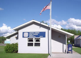
Fourtown and Minnie Township
are served by the Grygla Minnesota Post Office
US Post Office
107 S Main Avenue
Grygla, MN 56727-9998
Phone: (218) 294-6141
Toll Free: (800) ASK-USPSRegular Business Hours:
Week Days
8:00 am - 11:30 am
12:00 pm - 2:30 pm
Saturday
9:00 am - 9:45 am
 
|
 |
News:
Weather:
Map:
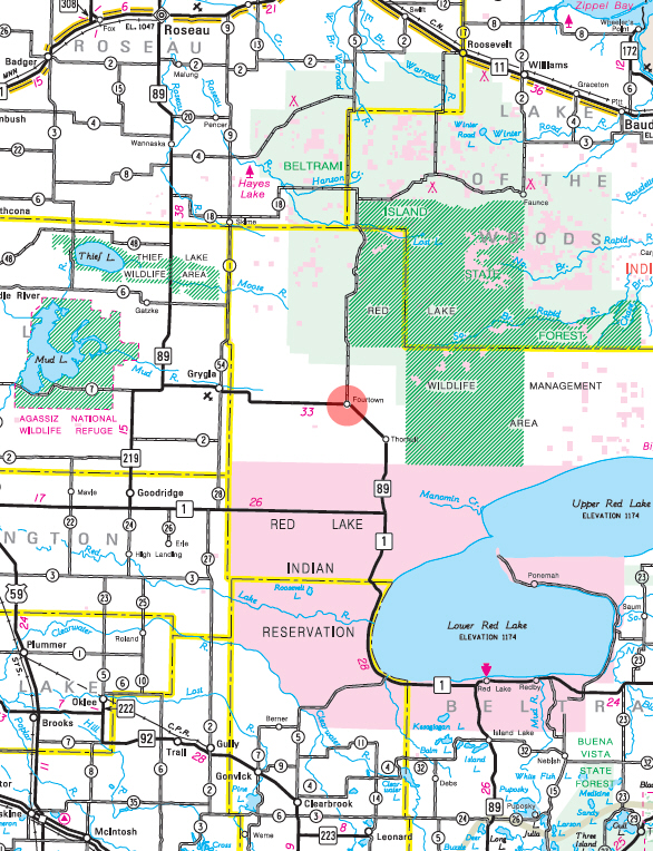 Minnesota State Highway Map of the Fourtown
Minnesota area
Events:
Attractions:
Recreation:
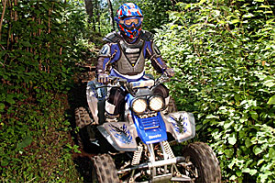
Fourtown-Grygla Trail
Ride 170 miles of trail stretched throughout northwestern
Minnesota. Much of this trail system follows county roads,
township roads, ditch banks and existing trails. County
ordinances allow ATVs to operate on the far right side of the
travel lane; highway-licensed vehicles share parts of the route
so use caution. The ConCon trails are also located nearby. The
trail system is provided by Beltrami County and maintained by
the Fourtown Grygla Sportsman's Club. |
 |
Lakes:
|
none
in the immediate area |
Health
Care:
Schools:
Churches:
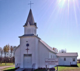
Our Saviors Lutheran
Church - ELCA
37048 Hamre Road NW
Grygla, MN 56727
Phone: (218) 294-6498
Pastor:
Mary Ronning Gilthvedt
Sunday Worship: 10:30 am |
 |
Media:
Motels:
|
none - nearest motel is 17 miles west in
Grygla |
Resorts:
Campgrounds:
Businesses:
Fourtown Grygla
Sportsmans Club
15925 120th Avenue NW
Thief River
Falls, MN 56701
Phone: n/a
Web:
www.fourtownsportsmans.com
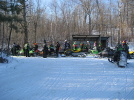
Organized in the 1960s as a
snowmobile club, the Fourtown Grygla Sportsmans Club,has emerged
into one of the most active sportsmens clubs in Northwest
Minnesota. Today the club has 63 family memberships with an
additional 55 individual memberships from the surrounding area.
The club was developed and now maintains approximately 240 miles
of Grant-In-Aid Snowmobile Trails. The club has also just
completed a project proposal to acquire,build and maintain 182
miles of a ATV Trail System in Beltrami County in the Grygla
Fourtown area. |
 |
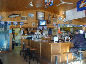
Fourtown Store and
Tavern
63063 Fourtown Road NW
Grygla, MN 56727
Phone: (218) 294-6460
Fifty
miles from a stoplight, nestled on the edge of the Beltrami
Island State Forest, Fourtown is an oasis in the wilderness.
Visitors enjoy hundreds of miles of pristine snowmobile and
fourwheeler trails and some of the best hunting in Minnesota.
Everyone's favorite bar, grill, convenience store, and gas
station up in God's Country! Come out for a beer and
cheeseburger, while enjoying some of the most pristine,
untouched wilderness in Minnesota. |
 |
Aerial Photo:
Topographic Map:
[click map to enlarge, zoom in or zoom out]
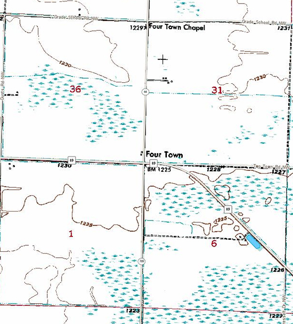 Topographic map is courtesy of the Minnesota DNR
-
click map to zoom or enlarge
|


