|
|
|
|
|
|
Navigation LakesnWoods.com
© 2004-2024 DCMA, Defamation, Copyright and Trademark Infingement Policy
|
|
||||||||||||||||||||||||||||||||||||||||||||||||||||||||||||||||||||||||||||||||||||||||||||||||||||||||||||||||||||||||||||||||||||||||||||||||||||||||||||||||||||||||||||||||||||
 |
 |
| Lewisville (city) | 1970 | 1980 | 1990 | 2000 | 2010 | 2000-2010 Change | |
|---|---|---|---|---|---|---|---|
| Actual | Percent | ||||||
| Population | 291 | 273 | 255 | 274 | 250 | -24 | -8.76 |
| Land Area (sq. mile) | 0.30 | 0.25 | 0.33 | 0.29 | 0.29 | 0 | 0.00 |
| Density (persons per sq. mile) | 970.0 | 1,092.0 | 772.7 | 936.1 | 862.1 | 74.0 | -8.76 |
| Housing Units | 127 | 130 | 128 | 126 | 116 | -10 | -7.94 |
| Households | -- | 127 | 118 | 113 | 101 | -12 | -10.62 |
| Persons Per Household | -- | 2.15 | 2.16 | 2.42 | 2.48 | +0.06 | +2.48 |
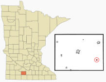
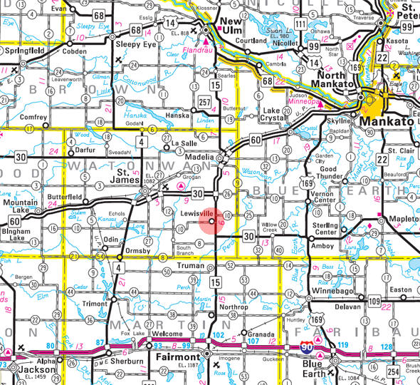
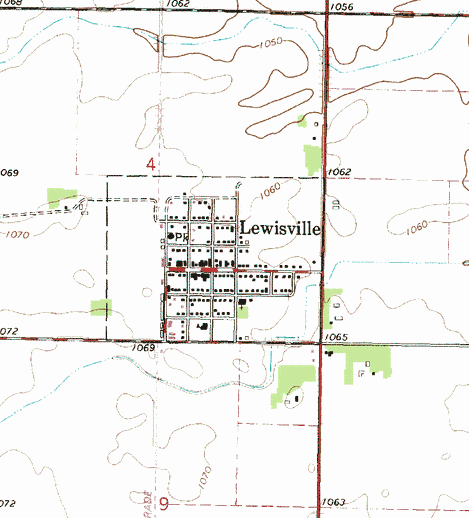
Lewisville is a city in Watonwan County, Minnesota. Minnesota State Highways 15 and 30 (co-signed) serve as a main route in the community. According to the United States Census Bureau, the city has a total area of 0.29 square miles (0.75 km2), all of it land. The elevation is 1,066 ft (325 m) above sea level.
From Wikipedia, the free encyclopedia.
As of the census of 2010, there were 250 people, 101 households, and 68 families residing in the city. The population density was 862.1 inhabitants per square mile (332.9/km2). There were 116 housing units at an average density of 400.0 per square mile (154.4/km2). The racial makeup of the city was 94.4% White, 1.6% African American, 0.4% Native American, 1.2% Asian, and 2.4% from two or more races. Hispanic or Latino of any race were 13.2% of the population.
There were 101 households of which 29.7% had children under the age of 18 living with them, 51.5% were married couples living together, 8.9% had a female householder with no husband present, 6.9% had a male householder with no wife present, and 32.7% were non-families. 27.7% of all households were made up of individuals and 10.9% had someone living alone who was 65 years of age or older. The average household size was 2.48 and the average family size was 3.07.
The median age in the city was 40 years. 26.8% of residents were under the age of 18; 8.4% were between the ages of 18 and 24; 18.4% were from 25 to 44; 29.2% were from 45 to 64; and 17.2% were 65 years of age or older. The gender makeup of the city was 53.2% male and 46.8% female.
Visit The
Minnesota History Shop! |
Courtesy Minnesota Historical Society
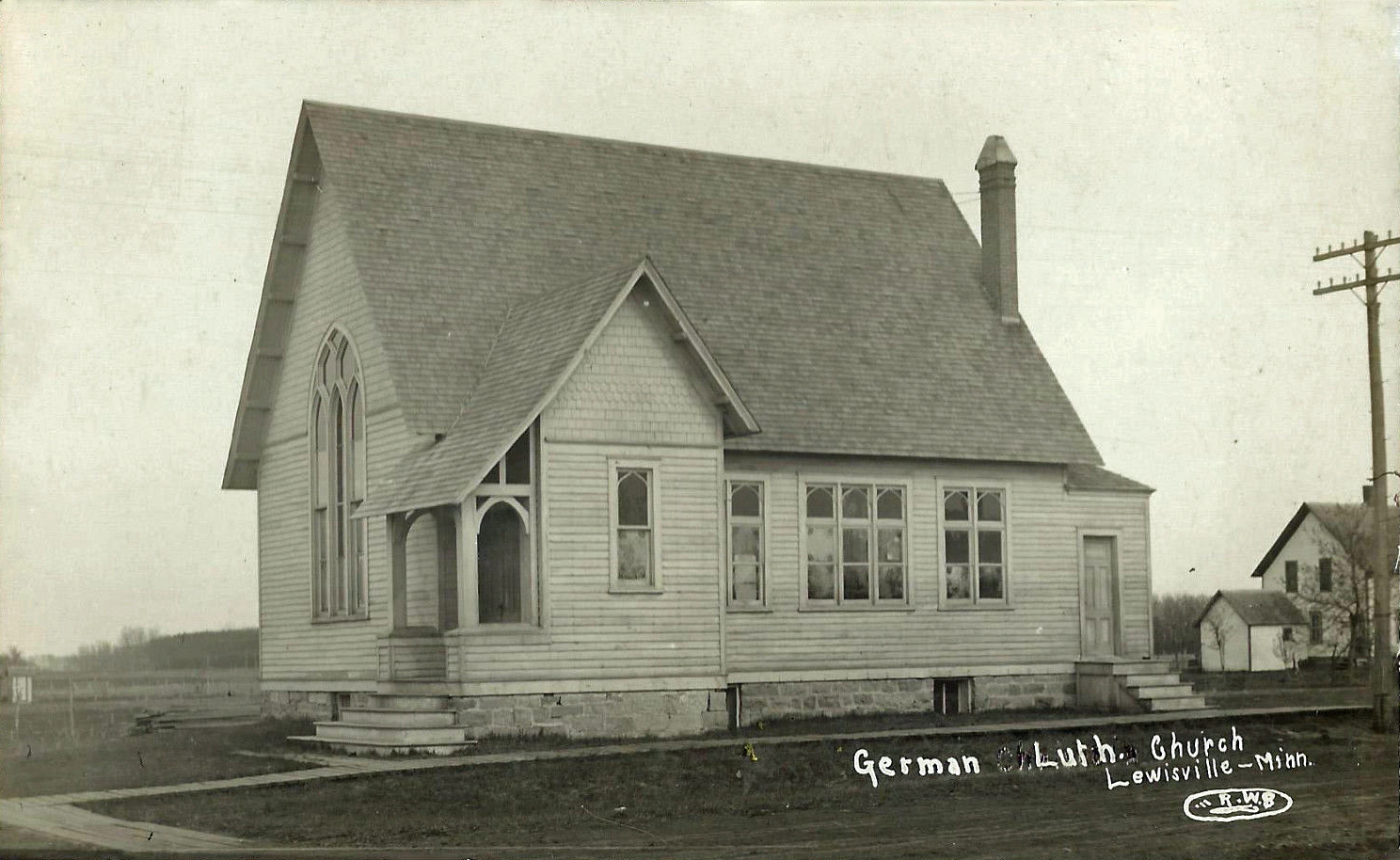 German Lutheran Church, Lewisville Minnesota, 1910s LakesnWoods.com Postcard and Postcard Image Collection - click to enlarge Visit The Lewisville Photo Gallery for more recent and historic area photos |
| Lewisville City Hall
PO Box 96
Lewisville, MN 56060
Phone: (507) 435-2022 Fax: (507) 435-4131 Regular Business Hours: Monday and Wednesday 6:00 pm - 8:00 pm Saturday 10:00 am - 12:00 pm City Council Meetings: 4th Monday of the month at 7:00 pm 


|
||||
| Title | Term Ends | Name | Phone | |
| Mayor | 12/31/2022 | Barbara Pfeil 329 Rockwood Street S Lewisville, MN 56060 |
(507)
435-2009 (507) 236-9136 |
|
| Clerk/Treasurer | appointed | Gayle Culbertson PO Box 96 Lewisville, MN 56060 |
|
(507) 435-2022 |
| Council Member | 12/31/2022 | Dennis Firchau 118 Rockwood Lewisville, MN 56060 |
(507) 435-4121 | |
| Council Member | 12/31/2022 | Douglas Gene Schultz
118 Martin Street E Lewisville, MN 56060 |
(507) 621-8127 | |
| Council Member | 12/31/2024 | Velma Albrent 209 Rockwood Street N Lewisville, MN 56060 |
(507) 435-2158 | |
| Council Member | 12/31/2024 | Dean Lewis 210 W Martin Street Lewisville, MN 56060 |
(507) 995-7464 | |
|
US Post Office 225 Lewis Street W Lewisville, MN 56060-4401 Phone: (507) 435-2091 Toll Free: (800) ASK-USPS
Regular Business Hours:   |
|
| Utility Type | Utility Name | Utility Phone |
| Electricity | South Central Electric Assn | (507) 375-3164 |
| Natural Gas | CenterPoint Energy | (800) 245-2377 |
| Wastewater | n/a | n/a |
| Water | City of Lewisville | n/a |
| Telephone | Frontier Communications | (800) 953-1504 |
| Cable TV | n/a | n/a |
| Employer | Products/Services | Employees |
| n/a | ||
Minnesota State
Highway Map of the Lewisville Minnesota area
| none |
Check Out
The Minnesota
History Shop! Good Goods and
Great Gifts! |
| none |
| none |
| Lake Name | Size (acres) |
Lake info | Lake Map | Rec Map | Topo Map |
|---|---|---|---|---|---|
| none in the immediate area | |||||
| none |
| none |
| Trinity Lutheran Church 83575 390th Street Lewisville, MN 56060 Phone: (507) 435-2434 |
|
| Zion Lutheran Church 102 Martin Street E Lewisville, MN 56060 Phone: (507) 435-4181 |
| none |
| none |
| none |
| none |
| Altenburg Construction Inc. 221 N PV Street Lewisville, MN 56060 Phone: (507) 435-2210 |
|
| Americana Cafe 233 Lewis Street W Lewisville, MN 56060 Phone: (507) 435-2831 |
|
| Bob's Service 39082 821st Lane Lewisville, MN 56060 Phone: (507) 435-2621 |
|
| Lewisville City Office 321 W Lewis Street Lewisville, MN 56060 Phone: (507) 435-2022 |
|
| Lewisville American Legion Post 121 Lewis Street E Lewisville, MN 56060 Phone: (507) 435-4711 |
|
| Lewisville Liquor Store 306 W Lewis Street Lewisville, MN 56060 Phone: (507) 435-9581 |
|
| Lewisville Public Library 105 Lewis Street W Lewisville, MN 56060 Phone: (507) 435-2781 |
|
| Pioneer Bank 301 W Lewis Street Lewisville, MN 56060 Phone: (507) 435-2451 |
|
|
|
|
© 2004-2024 Lakeweb1 Internet Services All Rights Reserved |
|
|
|
||