|
|
|
|
|
|
Navigation LakesnWoods.com
© 2004-2025 DCMA, Defamation, Copyright and Trademark Infingement Policy
'
|
|
|||||||||||||||||||||||||||||||||||||||||||||||||||||||||||||||||||||||||||||||||||||||||||||||||||||||||||||||||||||||||||||||||||||||||||||||||||||||||||||||||||||||||||||||||||||||||||||
|
|
|
| Tintah (city) | 1970 | 1980 | 1990 | 2000 | 2010 | 2000-2010 Change | |
|---|---|---|---|---|---|---|---|
| Actual | Percent | ||||||
| Population | 167 | 119 | 74 | 79 | 53 | -26 | -32.91 |
| Land Area (sq. mile) | 1.00 | 0.74 | 0.76 | 0.75 | 0.75 | 0 | 0.00 |
| Density (persons per sq. mile) | 167.00 | 160.81 | 97.37 | 104.65 | 70.67 | -33.98 | -32.47 |
| Housing Units | 64 | 63 | 46 | 45 | 34 | -11 | -24.44 |
| Households | -- | 54 | 34 | 37 | 29 | -8 | -21.62 |
| Persons Per Household | -- | 2.20 | 2.18 | 2.14 | 1.83 | -0.31 | -14.49 |
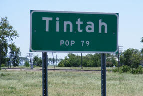
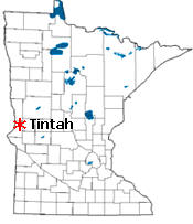
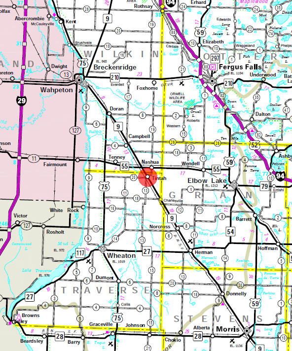
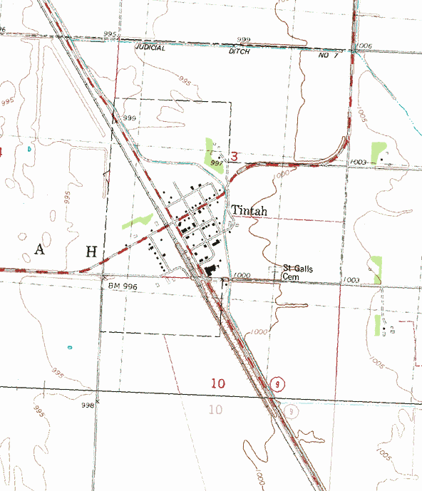
Tintah is a city in Traverse County, Minnesota. Minnesota Highway 9 serves as a main route in the community. Minnesota Highway 55 is nearby. According to the United States Census Bureau, the city has a total area of 0.76 square miles (1.97 km2), all of it land. The elevation is 1,001 feet (305 m).
From Wikipedia, the free encyclopedia.
As of the census of 2010, there were 63 people, 29 households, and 17 families residing in the city. The population density was 82.9 inhabitants per square mile (32.0/km2). There were 34 housing units at an average density of 44.7 per square mile (17.3/km2). The racial makeup of the city was 98.4% White and 1.6% from two or more races.
There were 29 households of which 24.1% had children under the age of 18 living with them, 37.9% were married couples living together, 13.8% had a female householder with no husband present, 6.9% had a male householder with no wife present, and 41.4% were non-families. 41.4% of all households were made up of individuals and 24.1% had someone living alone who was 65 years of age or older. The average household size was 2.17 and the average family size was 2.82.
The median age in the city was 44.3 years. 27% of residents were under the age of 18; 6.2% were between the ages of 18 and 24; 19.1% were from 25 to 44; 23.8% were from 45 to 64; and 23.8% were 65 years of age or older. The gender makeup of the city was 57.1% male and 42.9% female.
Visit The
Minnesota History Shop! |
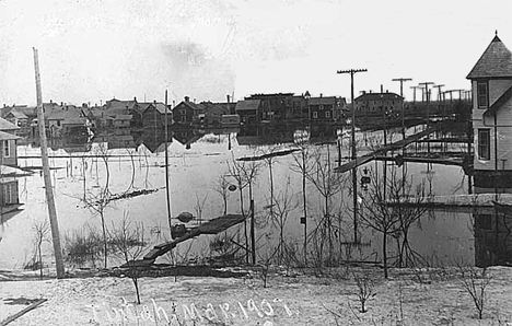
TINTAH Township, organized in 1881, received its name from the Dakota, this being their common word meaning "a prairie." The city in sections 3 and 10 was incorporated as a village on May 2, 1889, and separated from the township on April 27, 1906. The Great Northern Railway built a station in section 3 in 1872. The village was organized in 1881 and platted on March 1, 1887. Charles Smith became postmaster when the post office opened in 1880.
Hennepin wrote of the Dakota as "the Nation of the prairies, who are called Tintonha," a name derived from tintah. Later it has been written Tintonwans, Titonwans, or Tetons, comprising many Siouan bands ranging over southern and western Minnesota and onward to the vast country of plains west of the Missouri.
Courtesy Minnesota Historical Society
|
|
|
|
| Tintah City Hall 207 Ash Street Tintah, MN 56583 Phone: (218) 369-2150 Regular Business Hours: not available City Council Meetings: 3rd Monday of the month at 7:00 pm 


 |
||||
| Title | Term Ends | Name and Address | Phone: | |
| Mayor | 12/31/2022 | Randall Don Bullis
106 4th Street - PO Box 54 Tintah, MN 56583 |
|
(218) 369-2183 (218) 770-7835 |
| Clerk/Treasurer | appointed | name unavailable 207 Ash Avenue Tintah, MN 56583 |
|
(218) 369-2150 |
| Council Member | 12/31/2022 | Craig Carter 402 County Road 20 Tintah, MN 56583 |
(218) 770-3529 | |
| Council Member | 12/31/2022 | Jack Canterbury 206 Ash Avenue Tintah, MN 56583 |
|
(701) 640-8658 |
| Council Member | 12/31/2024 | Megan Albert 205 Ash Avenue Tintah, MN 56583 |
(701) 261-4688 | |
| Council Member | 12/31/2024 | Mike Kinn 207 Ash Avenue Tintah, MN 56583 |
(701) 640-1545 | |
| Utility Type | Utility Name | Utility Phone |
| Electricity | Otter Tail Power Company | (218) 739-8200 |
| Natural Gas | n/a | -- |
| Wastewater | n/a | -- |
| Water | n/a | -- |
| Telephone | Runestone Telephone Association | (320) 986-2013 |
| Cable TV | n/a | -- |
| Employer | Products/Services | Employees |
|
n/a |
||
|
none |
Check Out
The Minnesota
History Shop! Good Goods and
Great Gifts! |
|
none |
|
none |
| Lake Name | Size (acres) |
Lake info | Lake Map | Rec Map | Topo Map |
|---|---|---|---|---|---|
|
none in the immediate area |
|||||
|
none |
|
none |
| First Congregational Church PO Box 5 Tintah, MN 56583 Phone: (218) 369-2124 |
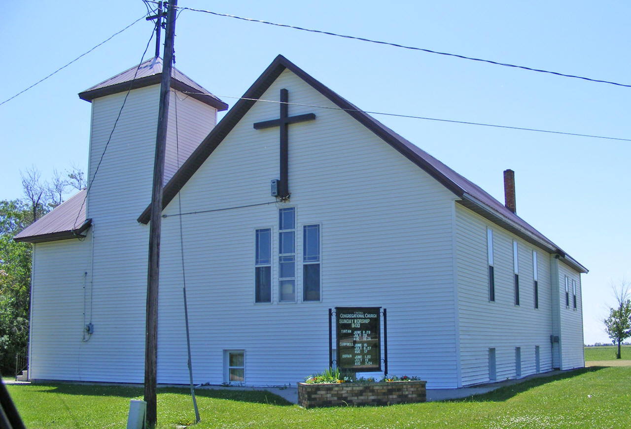 |
| St. Gall's Catholic Church 110 Minnesota Avenue Tintah, MN 56583 Phone: (218) 369-2188 |
 |
|
none |
|
none |
|
none |
|
none |
| 4-B Trucking Excavating &
Septic 105 5th Street Tintah, MN 56583 Phone: (218) 369-2474 |
|
| Daniels Shop 7775 750th Avenue Tintah, MN 56583 Phone: (218) 369-2487 |
|
| Davison Inc Shop 4848 320th Avenue Tintah, MN 56583 Phone: (218) 369-2190 |
|
| First Congregational Church PO Box 5 Tintah, MN 56583 Phone: (218) 369-2124 |
|
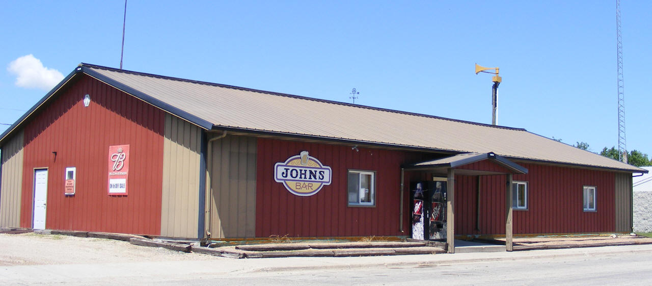
| John's Bar 103 3rd Street Tintah, MN 56583 Phone: (218) 369-2184 |
 |
| Keller Welding & Mfg 7623 County Road 19 Tintah, MN 56583 Phone: (218) 369-2136 |
|
| Minn Dak Weather Station HC 1 Tintah, MN 56583 Phone: (218) 630-5565 |
|
| Minn-Dak Farmers Co-Op Tintah, MN 56583 Phone: (218) 369-2406 |
|
| St. Gall's Catholic Church 110 Minnesota Avenue Tintah, MN 56583 Phone: (218) 369-2188 |
|
| Tintah Town Hall 105 3rd Street Tintah, MN 56583 Phone: (218) 369-2198 |
|
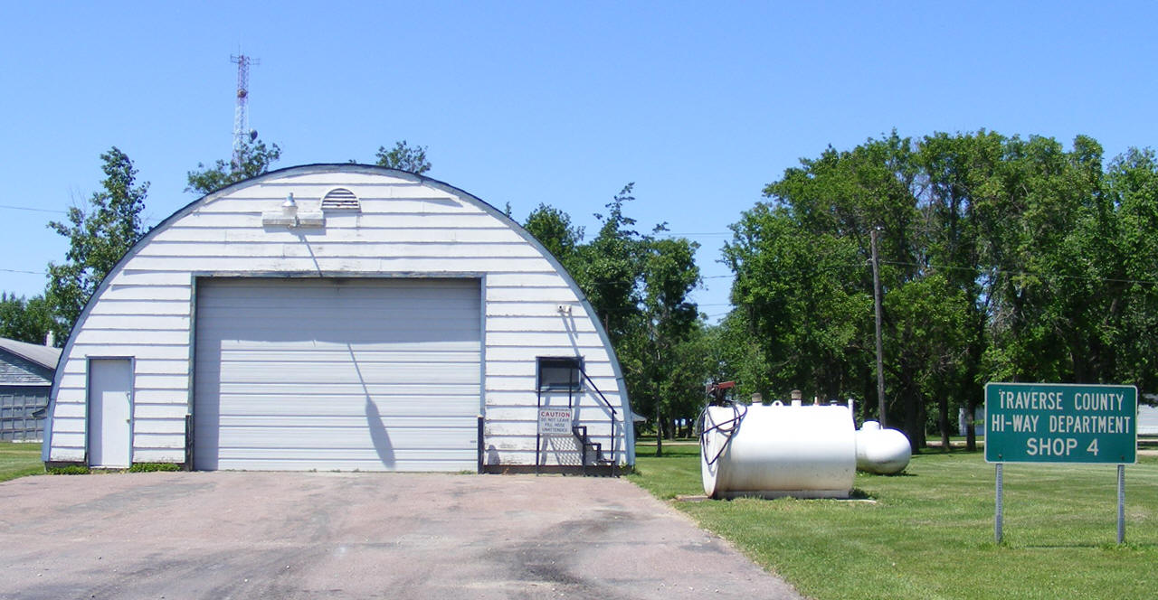
| Traverse County Garage Tintah, MN 56583 Phone: (218) 369-2428 |
 |
| US Post Office Main Street Tintah, MN 56583 Phone: (218) 369-2129 |
|
| Wheaton Dumont Co-Op
Elevator 206 250th Avenue Tintah, MN 56583 Phone: (218) 630-5556 |
|
|
|
|
© 2004-2025 LakesnWoods LLC All Rights Reserved |
|
|
|
||