|
Navigation LakesnWoods.com
Home
Page
Contact Us
Privacy
Minnesota History Shop
Visit The Minnesota History Shop
www.minnesotahistoryshop.com
Historic maps
Historic books
Historic framed art
Historic
postcards
Clothing with historic
images
And much more!!! |
Arden Hills Guide:
Photo Gallery
Location
Geography
Demographics
History
Government
Post Office
News
Weather
Street Map
Events
Attractions
Recreation
Lakes
Health Care
Schools
Churches
Media
Motels
Resorts
Campgrounds
Businesses
Aerial Photo
Topographic
Map © 2004-2025
LakesnWoods LLC
All Rights Reserved
DCMA, Defamation, Copyright and Trademark Infingement Policy
|
WANTED! Do you have photos, historical accounts or other
items pertaining to the Arden Hills area? Would you like to share this
historical information with the world? LakesnWoods.com would like
to publish your Arden Hills photos (current or historical) or historical
accounts on this website. Original materials can be returned and
your privacy will be respected.
Contact us |
|
Arden Hills Minnesota Gallery
|
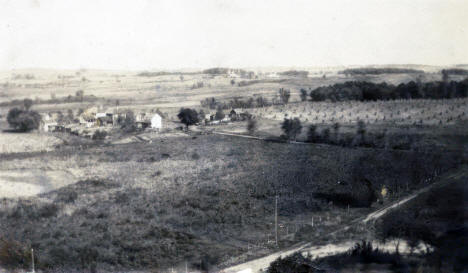
John Farrell property, present day Arden Hills, Minnesota,
1868
The farm of the
John Farrell family who came to America from Ireland in
1849. They bought their first 160 acres at Lake Johanna in
present-day Arden Hills, from Major McLean, the Indian
agent, and the title was signed by President Millard
Fillmore in 1868. The Farrell family donated the land for
St. John the Baptist Catholic Church. Today Mounds View High
School, the St. John's church, school and other parish
buildings, the Arden Hills Ramsey County Branch Library, and
the Minnesota Baptist Conference headquarters are on that
property.
Courtesy New
Brighton Area Historical Society - click image to
enlarge |
|
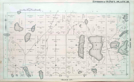
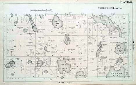
G. M. Hopkins plat map of Mounds View Township, Ramsey
County, Minnesota, 1886
Courtesy
John
R. Borchert Map Library - click image to enlarge |
|
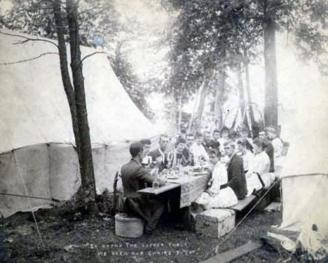
Men and women enjoying a picnic at Lake Johanna in present
day Arden Hills, Minnesota, 1890
Courtesy
Minnesota Historical Society
- click image to enlarge |
|
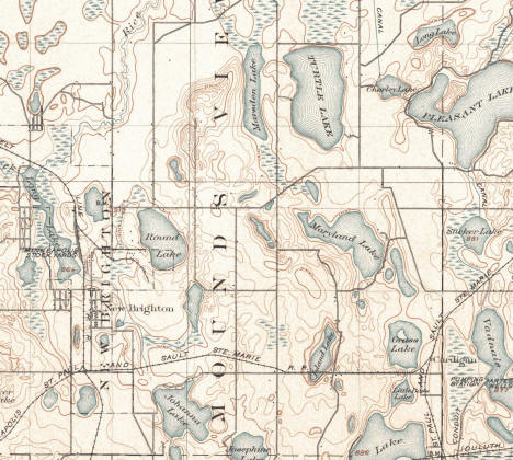
USGS Topographic Map of the Mounds View Township area, 1902
[shows elevation, water features, roads and buildings]
Courtesy
University of Alabama
- click image to enlarge |
|

William Perry, son of first Mounds View Township settler,
Charles Perry, at Lake Johanna in present day Arden Hills,
Minnesota, c1910
Courtesy
New Brighton Area
Historical Society - click image to enlarge |
|
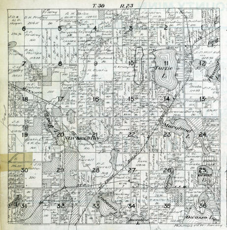
Plat map of Mounds View Township, Ramsey County, Minnesota,
1916
[shows land ownership]
Courtesy
John
R. Borchert Map Library - click image to enlarge |
|
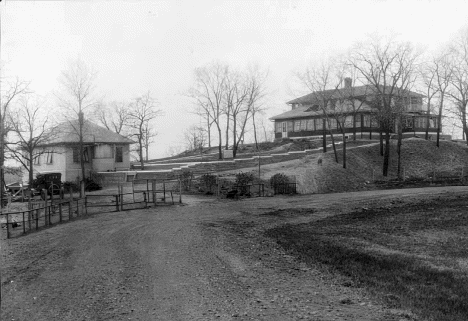
Lutheran Colony of Mercy, Lake Johanna, in present day Arden
Hills, Minnesota, 1920
Courtesy
Minnesota Historical Society
- click image to enlarge |
|
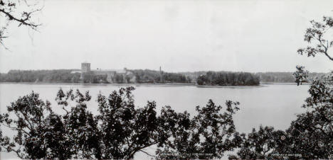
Nazareth Hall Prepatory Seminary on the shores of Lake
Johanna in present day Arden Hills, Minnesota, 1924
Courtesy
University of St.
Thomas Libraries - click image to enlarge |
|
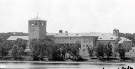
Nazareth Hall Preparatory Seminary , present day Arden
Hills, Minnesota, 1923
Nazareth Hall Preparatory Seminary (known also as Naz Hall)
was a high school seminary in Saint Paul, Minnesota serving
the Archdiocese of Saint Paul and Minneapolis. It was
founded in 1923 by Archbishop Austin Dowling and was closed
in 1971, being replaced by Saint John Vianney Seminary. The
campus is now the site of the University of Northwestern –
St. Paul.
Courtesy
MNDigital.org and
Wikipedia - click
image to enlarge
- click image to enlarge |
|

Twin Cities Ordnance News, December 4th, 1942
Courtesy
Library of Congress - click
image to enlarge |
|
☻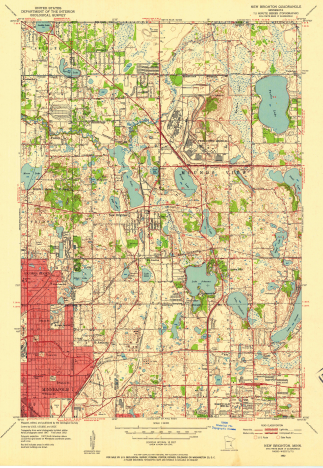
USGS Topographic Map of the Arden Hills, Minnesota area,
1954
[shows elevation, water features, roads and buildings]
Courtesy
Historical Topo Map Explorer - click image to enlarge |
|
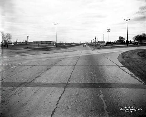
Intersection of Highways 8 and 10, Arden Hills; Twin Cities
Ordnance Plant at left, 1958
Courtesy Minnesota Historical
Society - click image to enlarge |
|
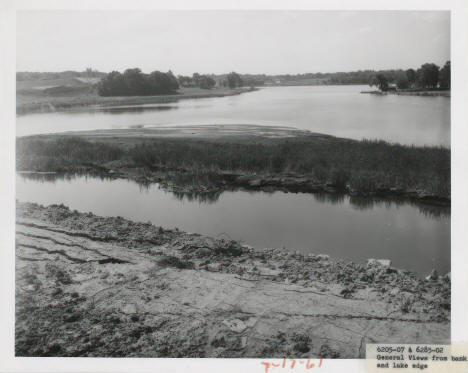
Lake Valentine and Interstate 694 project, Arden Hills,
Minnesota, 1961
Courtesy Minnesota
DOT - click image to enlarge |
|
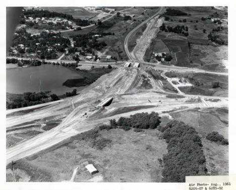
Aerial view of Lake Valentine and Interstate 694
construction project, Arden Hills, Minnesota, 1961
Courtesy
Minnesota DOT -
click image to enlarge |
|
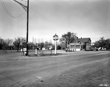
Standard gas station at the intersection of County Road D,
Johanna Boulevard, New Brighton Road and Fairview Avenue,
Arden Hills, Minnesota, 1964
Courtesy Minnesota Historical
Society -
click image to enlarge |
|
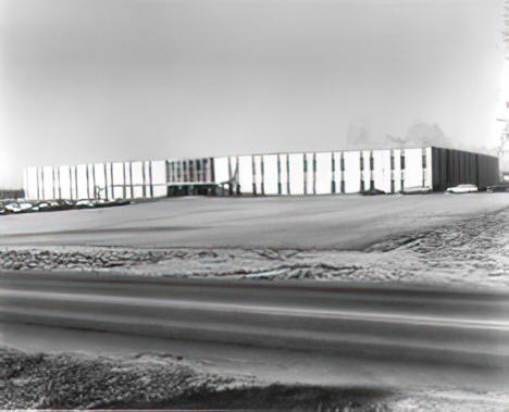
Control
Data Corporation's Arden Hills operations, 4201 Lexington
Avenue North, 1970
Courtesy Minnesota Historical
Society - no enlargement available |
|
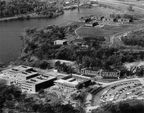
Aerial View of new Bethel complex under construction, Arden
Hills, Minnesota, 1972
Courtesy Minnesota Historical
Society - click image to enlarge |
|
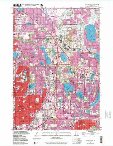
USGS Topographic Map of the Arden Hills, Minnesota area,
1997
[shows elevation, water features, roads and
buildings]
Courtesy
Historical Topo Map Explorer - click image to enlarge |
|
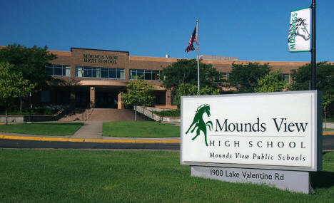
Mounds View High School, 1900 Lake Valentine Road, Arden
Hills, Minnesota, 2015
Courtesy Wikipedia
and Wikpedia user
McGhiever - click image to enlarge |
|
|


