

 |
 |
 |
|
|
Navigation
LakesnWoods.com Đ 2004-2025 DCMA, Defamation, Copyright and Trademark Infingement Policy
|
|
||||||||||||||||||||||||||||||||||||||||||||||||||||||||||||||||||||||||||||||||||||||||||||||||||||||||
 |
|
| Ball Bluff Township | 1970 | 1980 | 1990 | 2000 | 2010 | 2000-2010 Change | |
|---|---|---|---|---|---|---|---|
| Actual | Percent | ||||||
| Population | 283 | 335 | 257 | 300 | 278 | -22 | -7.33 |
| Land Area (sq. mile) | 34.80 | 37.74 | 33.86 | 33.86 | 33.86 | 0.00 | 0.00 |
| Density (persons per sq. mile) | 8.13 | 8.88 | 7.59 | 8.86 | 8.21 | -0.65 | -7.33 |
| Housing Units | 143 | 192 | 220 | 207 | -- | -- | -- |
| Households | -- | 121 | 102 | 121 | -- | -- | -- |
| Persons Per Household | -- | 2.77 | 2.52 | 2.48 | -- | -- | -- |
Ball Bluff Township is a township in Aitkin County, Minnesota. Minnesota State Highway 65 serves as a major arterial in the community. According to the United States Census Bureau, the township has a total area of 35.3 square miles (91.3 kmē), of which 33.9 square miles (87.7 kmē) is land and 1.4 square miles (3.7 kmē) (4.03%) is water. The elevation is 1,273 ft (388 m) above sea level.
There were 121 households out of which 28.9% had children under the age of 18 living with them, 62.0% were married couples living together, 3.3% had a female householder with no husband present, and 28.9% were non-families. 25.6% of all households were made up of individuals and 8.3% had someone living alone who was 65 years of age or older. The average household size was 2.48 and the average family size was 2.92.
In the township the population was spread out with 22.7% under the age of 18, 4.7% from 18 to 24, 25.3% from 25 to 44, 31.3% from 45 to 64, and 16.0% who were 65 years of age or older. The median age was 43 years. For every 100 females there were 102.7 males. For every 100 females age 18 and over, there were 101.7 males.
The median income for a household in the township was $33,750, and the median income for a family was $45,625. Males had a median income of $36,667 versus $21,500 for females. The per capita income for the township was $16,602. About 19.6% of families and 28.4% of the population were below the poverty line, including 47.9% of those under the age of eighteen and 10.5% of those sixty five or over.
Visit The
Minnesota History Shop! |
BALL BLUFF Township should be Bald Bluff, being for the conspicuous morainic drift hill so named, having a bald grassy top without trees, in section 32 of this township at the east side of the Mississippi. There was a village of this name in section 29.
Courtesy Minnesota Historical Society
|
|
| Ball Bluff Township Jacobson, MN 55752 |
||
| Chairperson |
Steve Saari 68353 198th Ave PO Box 562 Jacobson, MN 55752 |
(218) 752-6635 |
| Clerk |
Tamra Swing 18385 State Highway 200 PO Box 575 Jacobson, MN 55752 |
(218) 996-5852 |
| Treasurer |
Jacqueline Swing 8389 State Highway 200 Jacobson, MN 55752 |
(218) 752-1047 |
| Supervisor |
James Bagge 66378 186th Place Jacobson, MN 55752 |
(218) 752-1081 |
| Supervisor |
Dale Thompson 18400 State Hwy 200 Jacobson, MN 55752 |
(218) 244-2238 |
|
|
| none |

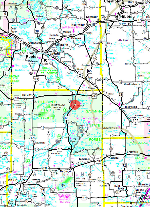
Minnesota State
Highway Map of the Ball Bluff Minnesota area
| none |
|
none |
| Savanna Lake Forest |
| none |
| none |
| none |
| none |
| none |
| none |
| none |
| none |

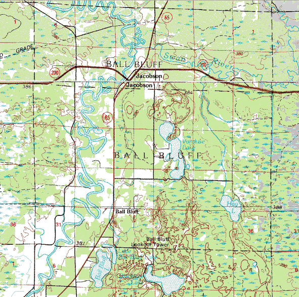
Topographic map is courtesy of the Minnesota DNR
- click map to zoom or enlarge
|
|
|
|
Đ 2004-2025
LakesnWoods LLC All Rights Reserved |
|
|
|
|||