|
Navigation
LakesnWoods.com
Home
Page
Contact Us
Privacy
Minnesota History Shop
Visit The Minnesota History Shop
www.minnesotahistoryshop.com
Historic maps
Historic books
Historic framed art
Historic
postcards
Clothing with historic
images
And much more!!! |
Boy River Guide:
Photo Gallery
Location
Geography
Demographics
History
Government
Post Office
News
Weather
Street Map
Events
Attractions
Recreation
Lakes
Health Care
Schools
Churches
Media
Motels
Resorts
Campgrounds
Businesses
Aerial Photo
Topographic
Map Nearby Communities
Bena
Deer River
Federal Dam
Longville
Remer © 2004-2025
LakesnWoods LLC
All Rights Reserved
DCMA, Defamation, Copyright and Trademark Infingement Policy
|
WANTED! Do you have photos, historical accounts or
other items pertaining to the Boy River area? Would you like
to share this historical information with the world? LakesnWoods.com
would like to publish your Boy River photos (current or historical)
or historical accounts on this website. Original materials can
be returned and your privacy will be respected.
Contact us |


|
Boy River Minnesota Community
Guide
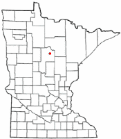
Location:
|
 |
 |
|
Boy River, incorporated in 1922, is the smallest
incorporated city in Cass County. Located on the Boy River between
Big Boy Lake and Leech Lake, the river is a vital part of the
community's history and future. Transportation by land has always been limited.
Mostly surrounded by swamps and dense forest, the community
is located on a hill of rock and clay. The river was the easiest
way to travel. Boats used to leave Walker and cross Leech Lake
and travel up the river, they would then dock at the on southern
edge of town.This was where the railroad had a "spur". Much timber,
mostly white pine and cedar, was lifted from the river at
this spot, loaded on the trains, and shipped to Duluth.
Boy River is now an access for canoes and
non-motorized boats, and provides an outhaul spot for those
who don't wish to continue on to large open waters of Leech
Lake.
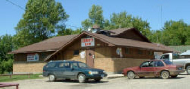
The Soo Line Trail runs through town, and brings many
travelers into Boy River for a quick bite to eat or beverage
at Jerry's Bar and Steakhouse.
With much of the area in and around Boy River protected
by its topography, our town will most likely stay the size
that it is.
|
Population:
Boy River
(city) |
1970 |
1980 |
1990 |
2000 |
2010 |
2000-2010 Change |
| Actual |
Percent |
| Population |
44 |
50 |
43 |
38 |
47 |
+9 |
+23.68 |
| Land Area (sq. mile) |
0.50 |
0.58 |
0.43 |
0.43 |
0.43 |
0 |
0.00 |
| Density (persons per sq. mile) |
88.00 |
86.21 |
100.00 |
89.02 |
109.30 |
+20.28 |
+22.78 |
| Housing Units |
30 |
36 |
33 |
27 |
33 |
+6 |
+22.22 |
| Households |
-- |
24 |
19 |
18 |
21 |
+3 |
+16.67 |
| Persons Per Household |
-- |
2.08 |
2.26 |
2.11 |
2.24 |
+0.13 |
+6.16 |
Geography:Boy River is a city in Cass County, Minnesota. According
to the United States Census Bureau, the city has a total area of 0.37
square miles (0.96 km≤), all of it land. County Road 4 is the major
arterial in the city. The elevation is 1,329 ft (405
m) above sea level.
Demographics:
As of the census of 2010, there were 47 people,
21 households, and 10 families residing in the city.
The population density was 127.0 inhabitants per
square mile (49.0/km2). There were 33 housing units
at an average density of 89.2 per square mile
(34.4/km2). The racial makeup of the city was 100.0%
White.
There were 21 households of which 38.1% had
children under the age of 18 living with them, 23.8%
were married couples living together, 19.0% had a
female householder with no husband present, 4.8% had
a male householder with no wife present, and 52.4%
were non-families. 52.4% of all households were made
up of individuals and 14.3% had someone living alone
who was 65 years of age or older. The average
household size was 2.24 and the average family size
was 3.10.
The median age in the city was 33.5 years. 31.9%
of residents were under the age of 18; 6.4% were
between the ages of 18 and 24; 27.7% were from 25 to
44; 27.6% were from 45 to 64; and 6.4% were 65 years
of age or older. The gender makeup of the city was
44.7% male and 55.3% female.
From
Wikipedia, the
free encyclopedia
History:
Boy River, a city of Boy River Township,
sections 29 and 32; incorporated as a village on April 7, 1922; the
post office was established in 1910. The village had a station of the
Minneapolis, St. Paul and Sault Ste. Marie Railroad (Soo Line) and several
hotels and general stores. Courtesy
Minnesota Historical Society
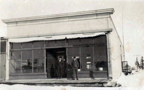
General store, Boy River Minnesota, 1920s
LakesnWoods.com Postcard and Postcard Image Collection - click to enlarge
Visit
The Boy
River Photo Gallery for more recent and
historic area photos |
Government:
City of
Boy River
112 Main Street S
Boy River, MN 56672
Phone: (218) 889-2233
Regular Business
Hours:
not available
City Council Meetings:
1st
Tuesday of the month at 7:00 pm


|
|
|
Title |
Term Ends |
Name and Address |
|
Phone |
| Mayor |
n/a |
not available |
|
n/a |
| Clerk |
n/a |
not available |
|
n/a |
| Treasurer |
n/a |
not available |
|
n/a |
| Council Member |
n/a |
not available |
|
n/a |
| Council Member |
n/a |
not available |
|
n/a |
| Council Member |
n/a |
not available |
|
n/a |
| Council Member |
n/a |
not available |
|
n/a |
Post
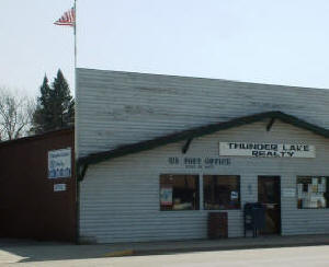
Office: Boy River had a post office
from 1910 until 1985. Boy River is currently served by the Remer
Post Office
US Post Office
117 Main Street E
Remer, MN 56672-4549
Phone: (218) 566-2381
Toll Free: (800) ASK-USPS
Regular Business Hours:
Week Days 8:30 am -
12:00 pm
1:00 pm - 3:45 pm
Saturday
9:30 am - 10:00 am


|
 |
Utilities:
Major Employers:
|
Employer |
Products/Services |
Employees |
| n/a |
News:
Weather:
Map:
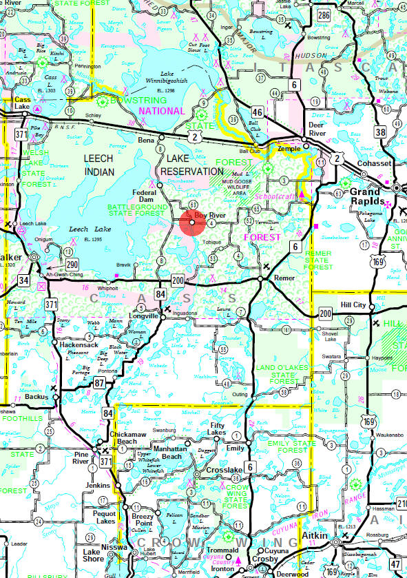
Minnesota
State Highway Map of the Boy River Minnesota area
Events:
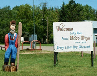
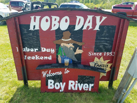
Hobo Day
Annually on Saturday of Labor
Day weekend, this celebration has been held for over 50 years.
Originally this festivity started as a way to give bragging
rights to the gardeners of the Left Handerís Club. However,
when the farming and gardening became more of a past time rather
than a necessity, vegetable judging was no longer part of the
events.

 |
 |
Attractions:
Recreation:
|
Boy River Canoe Route
As you travel the
river and lakes of the Boy River Canoe Tour, take time to
notice the changes in the Forest. You will be paddling by
three very different forest types, including lowland
conifer, upland hardwood and sedge meadow. Though the route
is mainly slow, meandering river, it does have many
lake-like characteristics. The prime time to travel is
mid-May through July. The route follows the lower part of
the Boy River drainage which starts at Ten Mile Lake south
of Walker and flows southeast and then north through Woman
Lake. Here it enters the Chippewa National Forest. From this
point, the river flows through Boy Lake and on to Boy Bay of
Leech Lake, which turns and flows into the Mississippi River
through the Leech Lake River.


|
|
|
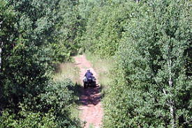
Soo Line North ATV Trail
The
Soo Line North ATV Trail is a 112 mile trail running through
Carlton, Aitkin and Cass Counties. The trail consists of three
main sections: from Moose Lake to Lawler, from Lawler to Shovel
Lake, from Shovel Lake to Cass Lake. The portion from Shovel
Lake to Cass Lake is mostly forested with several large bogs.
Portions of the trail run through Savanna State Forest, Bowstring
State Forest, and Chippewa National Forest.


|
|
Lakes:
|
Lake Name |
Size
(acres) |
Lake info |
Lake Map |
Rec Map |
Topo Map |
| Boy Lake |
3,466 |
 |
 |
 |
|
Health
Care:
Schools:
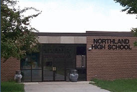
Boy River is part of
Independent
School District 118.
Students attend school in Remer, MN
Churches:
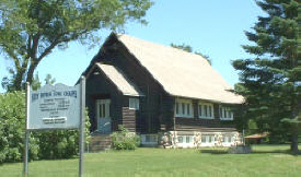
Boy River Log
Chapel
329 2nd Avenue E
Boy River, MN 56672
Phone: (218) 889-2237
Pastor: n/a
Sunday Worship: 10:00 am


|
 |
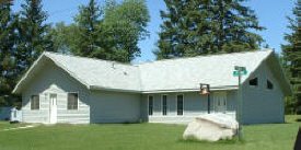
Faith United Fellowship
2418 102nd Street NE
Boy River, MN 56672
Phone: (218) 889-2445
Pastor: n/a
Sunday Worship: 10:30 am

|
|
Zion Lutheran Church - ELCA
222 2nd Avenue
Boy River, MN 56672
Phone: (218) 889-2533
Pastor: n/a
Sunday Worship: 9:30 am

|
 |
Businesses:
Aerial
Map:
Topographic Map:
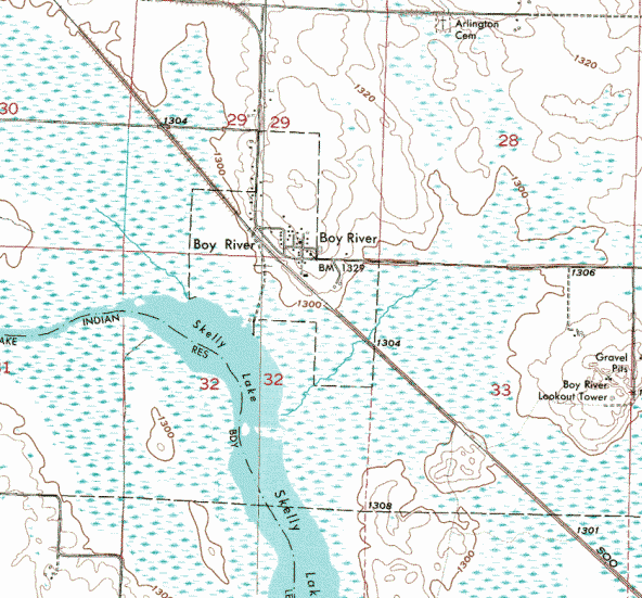
Topographic map is courtesy of the Minnesota DNR - click map to zoom or enlarge
|
|


