|
|
|
|
|
|
Navigation LakesnWoods.com
© 2004-2025 DCMA, Defamation, Copyright and Trademark Infingement Policy
|
|
||||||||||||||||||||||||||||||||||||||||||||||||||||||||||||||||||||||||||||||||||||||||||||||||||||||||||||||||||||||||||||||||||||||||||||||||||||||||||||||||||||||||||||||||||||||||||||||||||||||
 |
 |
| Cedar Mills (city) | 1970 | 1980 | 1990 | 2000 | 2010 | 2000-2010 Change | |
|---|---|---|---|---|---|---|---|
| Actual | Percent | ||||||
| Population | 81 | 73 | 80 | 53 | 45 | -8 | -15.10 |
| Land Area (sq. mile) | 0.40 | 0.51 | 0.44 | 0.44 | 0.44 | 0 | 0.00 |
| Density (persons per sq. mile) | 202.50 | 143.14 | 181.82 | 121.80 | 102.27 | -19.53 | -16.03 |
| Housing Units | 28 | 25 | 30 | 27 | 24 | -3 | -11.11 |
| Households | -- | 25 | 26 | 26 | 23 | -3 | -11.54 |
| Persons Per Household | -- | 2.92 | 3.08 | 2.04 | 1.96 | -0.08 | -3.92 |
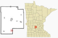
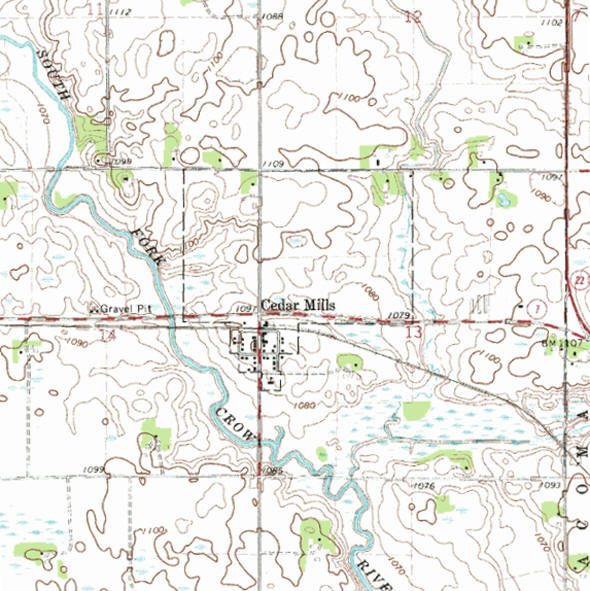
Cedar Mills is a city in Meeker County, Minnesota. Minnesota State Highways 7 and 22 are two of the main routes in the community. According to the United States Census Bureau, the city has a total area of 0.34 square miles (0.88 km2), all of it land. The elevation is 1,096 ft (334 m).
From Wikipedia, the free encyclopedia.
As of the census of 2010, there were 45 people, 23 households, and 14 families residing in the city. The population density was 132.4 inhabitants per square mile (51.1/km2). There were 24 housing units at an average density of 70.6 per square mile (27.3/km2). The racial makeup of the city was 93.3% White, 2.2% Asian, and 4.4% from two or more races.
There were 23 households of which 13.0% had children under the age of 18 living with them, 52.2% were married couples living together, 8.7% had a female householder with no husband present, and 39.1% were non-families. 39.1% of all households were made up of individuals and 17.4% had someone living alone who was 65 years of age or older. The average household size was 1.96 and the average family size was 2.57.
The median age in the city was 49.3 years. 13.3% of residents were under the age of 18; 6.7% were between the ages of 18 and 24; 24.3% were from 25 to 44; 35.6% were from 45 to 64; and 20% were 65 years of age or older. The gender makeup of the city was 35.6% male and 64.4% female.
Visit The
Minnesota History Shop! |
Courtesy Minnesota Historical Society
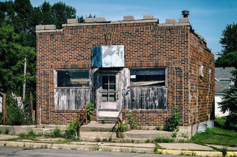
Old Storefront, Cedar Mills Minnesota, 2018
From the
Capture Minnesota
website, taken by Justin Beck
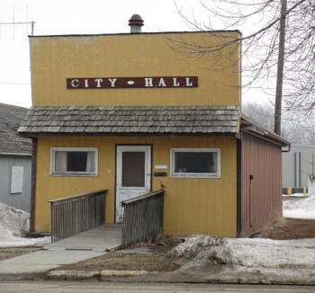
| Cedar Mills City Hall 13484 County Road 26 PO Box 565 Hutchinson, MN 55350 Phone: (320) 587-5541 Regular Business Hours: unknown City Council Meetings: 2nd Monday of the month, call for time
|
 |
|||
| Title | Term Ends | Name and Address | Phone | |
| Mayor | 12/31/2022 | Brian Hettver 62072 134th Street Hutchinson, MN 55350 |
(320) 455-7502 | |
| Clerk | 12/31/2022 | Kata Dahlman 61917 134th Street Hutchinson, MN 55350 |
 |
(320) 583-6075 |
| Council Member | 12/31/2022 |
James McCarthy 13470 621st Avenue Hutchinson MN 55350 |
(320) 234-6055 | |
| Council Member | 12/31/2022 | Robert
Mortensen 13339 County Road 26 Hutchinson MN 55350 |
(320) 587-7864 | |
| Council Member | 12/31/2024 | vacant address unavailable Hutchinson MN 55350 |
-- | |
| Council Member | 12/31/2024 | Clint Millerbernd 13427 621st Avenue Hutchinson MN 55350 |
(320) 234-3436 | |
|
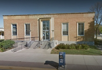
US Post Office 245 Main Street S Hutchinson, MN 55350-2579 Phone: (320) 587-2497 Toll Free: (800) ASK-USPS Fax: (320) 587-1086 Regular
Business Hours:   |
 |
| Utility Type | Utility Name | Utility Phone |
| Electricity | Meeker Coop Light & Power Assn | (320) 693-3231 |
| Natural Gas | n/a | -- |
| Wastewater | n/a | -- |
| Water | n/a | -- |
| Telephone | Nuvera | (844) 354-4111 |
| Cable TV | n/a | -- |
| Employer | Products/Services | Employees |
| n/a | ||
|
|
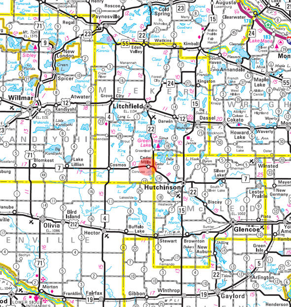
Minnesota State
Highway Map of the Cedar Mills Minnesota area
| none |
Check Out
The Minnesota
History Shop! Good Goods and
Great Gifts! |
| none |
|
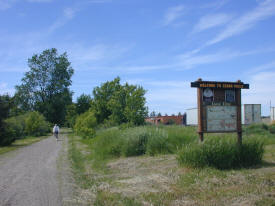
Luce Line Trail The Luce Line State Trail is a 63 mile long former railroad grade which is developed for biking, hiking, horseback riding, mountain biking, snowmobiling, and skiing. The limestone surfaced trail runs from Plymouth 30 miles west to Winsted, with a parallel treadway for horseback riding. From Winsted to Hutchinson, the trail is paved, from Hutchinson to Cedar Mills it is crushed granite and Cedar Mills to Cosmos it is Natural (mowed grass). Snowmobiles are allowed on the trail west of Stubb's Bay Road. |
 |
| Lake Name | Size (acres) |
Lake info | Lake Map | Rec Map | Topo Map |
|---|---|---|---|---|---|
| Atkinson | 134 |
|
|
||
| Coombs | 64 |
|
|
||
| Harden | 148 |
|
|
||
| Hoff | 139 |
|
|
|
|
| Sioux | 410 |
|
|
|
| none |
| none |
| none |
| none |
| none |
| none |
|
|
|
|
|
|
© 2004-2025 LakesnWoods LLC All Rights Reserved |
|
|
|
||