|
|
|
|
|
|
Navigation LakesnWoods.com
© 2004-2025 DCMA, Defamation, Copyright and Trademark Infingement Policy
|
|
|||||||||||||||||||||||||||||||||||||||||||||||||||||||||||||||||||||||||||||||||||||||||||||||||||||||||||||||||||||||||||||||||||||||||||||||||||||||||||||||||||||||||||||||||||||||||||||||||||||||||||||||||||||||||||
 |
| Edina (city) | 1970 | 1980 | 1990 | 2000 | 2007 (est) |
1990-2000 Change | |
|---|---|---|---|---|---|---|---|
| Actual | Percent | ||||||
| Population | 44,046 | 46,073 | 46,070 | 47,425 | 47,090 | 1,355 | 2.94 |
| Land Area (sq. mile) | 15.20 | 15.94 | 15.74 | 15.75 | -- | 0.01 | 0.05 |
| Density (persons per sq. mile) | 2,897.76 | 2,890.40 | 2,926.94 | 3,011.44 | -- | 84.50 | 2.89 |
| Housing Units | 13,313 | 18,655 | 20,983 | 21,669 | -- | 686 | 3.27 |
| Households | -- | 17,961 | 19,860 | 20,996 | 21,250 | 1,136 | 5.72 |
| Persons Per Household | -- | 2.55 | 2.30 | 2.24 | 2.19 | -0.06 | -2.66 |
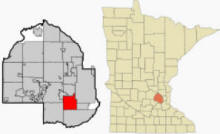
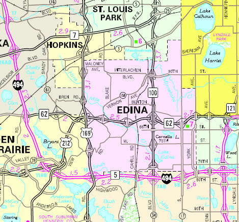
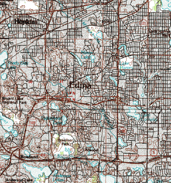
Edina is a city in Hennepin County, Minnesota, United States, and a first-ring suburb situated immediately southwest of Minneapolis. Many major highways run through or are close to Edina, making it readily accessible to those within the metropolitan area. Minnesota State Highways 62 and 100 divide the City into four sections. U.S. Route 169 and Minnesota State Highway 100 extend north and south. Interstate 494 and Minnesota State Highway 62 extend east and west. According to the United States Census Bureau, the city has a total area of 41.5 km² (16.0 mi²). 40.8 km² (15.8 mi²) of it is land and 0.8 km² (0.3 mi²) of it (1.87%) is water. The elevation is 922 ft (281 m).
From Wikipedia, the free encyclopedia.
There were 20,996 households out of which 26.5% had children under the age of 18 living with them, 53.8% were married couples living together, 5.8% had a female householder with no husband present, and 38.7% were non-families. 34.0% of all households were made up of individuals and 18.5% had someone living alone who was 65 years of age or older. The average household size was 2.24 and the average family size was 2.91.
In the city the population was spread out with 22.9% under the age of 18, 4.4% from 18 to 24, 23.6% from 25 to 44, 26.5% from 45 to 64, and 22.7% who were 65 years of age or older. The median age was 44 years. For every 100 females there were 84.6 males. For every 100 females age 18 and over, there were 79.7 males.
According to a 2007 estimate, the median income for a household in the city was $76,805, and the median income for a family was $114,673. Males had a median income of $67,011 versus $41,742 for females. The per capita income for the city was $44,195. About 2.0% of families and 3.3% of the population were below the poverty line, including 3.6% of those under age 18 and 2.8% of those age 65 or over.
Visit The
Minnesota History Shop! |
Courtesy Minnesota Historical Society
|
Edina City Hall 4801 W 50th Street Edina, MN 55424 Phone: (952) 927-8861 Fax: (952) 826-0390 Regular Business Hours: Monday - Friday 8:00 am to 4:30 pm City Council
Meetings:
|
||||
| Title | Term Ends | Name and Address | Phone | |
| Mayor | 12/31/2022 | James B. Hovland 5023 Nob Hill Drive Edina, MN 55439 |
 |
(612)
874-8551 (612) 961-6192 |
| City Manager | appointed | Scott Neal 4801 W 50th Street Edina, MN 55424 |
|
(952) 826-0401 |
| Council Member | 12/31/2022 | Ron Anderson 5728 Kemrich Drive Edina, MN 55439 |
|
(952)
833-9549 (612) 386-3208 |
| Council Member | 12/31/2022 | Kevin Staunton 5277 Lochloy Drive Edina, MN 55436 |
|
(952) 836-1020 |
| Council Member | 12/31/2024 | James Pierce 5505 Merritt Circle Edina, MN 55436 |
|
(952)
833-9548 (763) 607-3160 |
| Council Member | 12/31/2024 | Carolyn Jackson 5716 Continental Drive Edina, MN 55436 |
|
(952)
833-9547 (952) 836-1770 |
|
US Post Office 3948 W 49½ Street Edina, MN 55424-9998 Phone: (952) 926-6569 Toll Free: (800) ASK-USPS   |
|
||
|
|||
| Utility Type | Utility Name | Utility Phone |
| Electricity | Xcel Energy | (800) 895-4999 |
| Natural Gas | CenterPoint Energy | (800) 269-1114 |
| Wastewater | Metropolitan Council Environmental Svc | (612) 222-8423 |
| Water | Edina Municipal | (612) 927-8861 |
| Telephone | CenturyLink Communications | (800) 603-6000 |
| Cable TV | Comcast | (612) 522-2000 |
| Employer | Products/Services | Employees |
| Jerry's Enterprises, Inc. | Grocery Stores | 4,500 |
| Fairview Southdale Hospital | General Medical & Surgical Hospitals | 2,500 |
| Marshall Field's | Department Stores | 1,200 |
| Edina Public Schools ISD #273 | Elementary & Secondary Schools | 1,172 |
| Nash Finch Company | Grocery Stores | 350 |
| International Dairy Queen Inc | Full-Service Restaurants | 300 |
| City of Edina | Executive, Legislative, & Other Gen. Govt. Support | 262 |
| JC Penney Company | Department Stores | 250 |
| Edina Realty | Offices of Real Estate Agents & Brokers | 210 |
| Con Agra Foods-Snack Food Gr. | Other Snack Food Mfg. | 196 |
Minnesota State
Highway Map of the Edina Minnesota area
Check Out
The Minnesota
History Shop! Good Goods and
Great Gifts! |
| Lake Name | Size (acres) |
Lake info | Lake Map | Rec Map | Topo Map |
|---|---|---|---|---|---|
|
|
|
|
|
| Local | |
| Metro | |
|
see the Twin Cities Media Guide page for Twin Cities metro area newspapers, radio and TV |
|
|
|
|
|
|
|
© 2004-2025 LakesnWoods LLC All Rights Reserved |
|
|
|
||