|
Navigation
LakesnWoods.com
Home
Page
Contact Us
Privacy
Minnesota Gift Guide
Marble Guide:
Photo Gallery
Location
Geography
Demographics
History
Government
Post Office
News
Weather
Street Map
Events
Attractions
Recreation
Lakes
Health Care
Schools
Churches
Media
Motels
Resorts
Campgrounds
Businesses
Aerial Photo
Topographic Map Nearby Communities:
Bovey
Calumet
Cohasset
Coleraine
Grand
Rapids
Keewatin
Hibbing
LaPrairie
Pengilly
Marcell
Nashwauk
Taconite
Warba © 2004-2025
LakesnWoods LLC
All Rights Reserved
DCMA, Defamation, Copyright and Trademark Infingement Policy
|
WANTED! Do you have photos, historical accounts or
other items pertaining to the Marble area? Would you like to
share this historical information with the world?
LakesnWoods.com would like to publish your Marble photos
(current or historical) or historical accounts on this website.
Original materials can be returned and your privacy will be
respected.
Contact us |
|
Marble Minnesota Community Guide
Location:
Population:
| Marble (city) |
1970 |
1980 |
1990 |
2000 |
2010 |
2000-2010
Change |
| Actual |
Percent |
| Population |
682 |
757 |
618 |
695 |
701 |
+6 |
+0.01 |
| Land Area (sq. mile) |
-- |
-- |
-- |
4.4 |
4.4 |
0 |
0.00 |
| Density (persons per sq. mile) |
-- |
-- |
-- |
161.3 |
157.5 |
-3.77 |
-2.34 |
| Housing Units |
-- |
-- |
-- |
308 |
315 |
+7 |
+2.27 |
| Households |
-- |
-- |
-- |
287 |
281 |
-7 |
-2.44 |
| Persons Per Household |
-- |
-- |
-- |
2.42 |
2.49 |
+0.07 |
+2.89 |
Geography:
Marble is a city in Itasca County, Minnesota. U.S. Route 169 serves as a
main route in the community. According to the United States Census
Bureau, the city has a total area of 4.45 square miles (11.53 km˛), of which,
4.35 square miles (11.27 km˛) of it is land and 0.10 square miles (0.26 km˛) of
it is water. The elevation is 1,417 ft (432 m) above sea level.
From
Wikipedia, the free
encyclopedia.
Demographics:
As of the census of 2010, there were 701 people, 281 households, and
174 families residing in the city. The population density was 161.1
inhabitants per square mile (62.2/km2). There were 315 housing units at an
average density of 72.4 per square mile (28.0/km2). The racial makeup of the
city was 93.4% White, 0.6% African American, 3.1% Native American, 0.4%
Asian, and 2.4% from two or more races. Hispanic or Latino of any race were
0.3% of the population.
There were 281 households of which 32.7% had children
under the age of 18 living with them, 41.6% were married couples living
together, 13.9% had a female householder with no husband present, 6.4% had a
male householder with no wife present, and 38.1% were non-families. 31.0% of
all households were made up of individuals and 9.6% had someone living alone
who was 65 years of age or older. The average household size was 2.47 and
the average family size was 3.04.
The median age in the city was 38.2 years. 27.8% of
residents were under the age of 18; 6.2% were between the ages of 18 and 24;
26.6% were from 25 to 44; 25.6% were from 45 to 64; and 13.8% were 65 years
of age or older. The gender makeup of the city was 53.5% male and 46.5%
female.
From
Wikipedia, the free
encyclopedia.
History:
Marble, a city in Greenway Township, sections 16-20, was
incorporated as a village on April 20, 1909. The first homestead claim was
in 1888 by Albert F. Gross of Duluth, which became the Gross-Marble Mining
Company property; the village was enlarged in 1908 by the Oliver Mining
Company, at which time 20 of its 80 acres were reserved for a public park.
The post office began in 1908. Courtesy
Minnesota Historical Society
Government:
Marble City Hall
302 Alice Avenue
PO Box 38
Marble, MN 55764
Phone: (218)
247-7576
Fax: (218) 247-7555
Regular Business Hours:
Monday and
Tuesday 4:00 pm - 6:00 pm
Thursday and Friday 7:30 am - 10:30 am
City Council
Meetings:
2nd Monday of the month at 5:30 pm


 |
|
| Title |
Term Ends |
Name and
Address |
|
Phone |
| Mayor |
12/31/2022 |
Daidre Breen
200 South Avenue - PO Box 361
Marble, MN 55764 |
 |
(218)
256-0425
(218) 247-7253 |
| Clerk |
12/31/2024 |
Sarah Litchke
100
Kate Street
Marble, MN 55764 |
 |
(218)
256-1168 |
| Treasurer |
12/31/2022 |
Patricia
(Patti) M.Rychart
56 Ball Street
Bovey, MN 55709 |
 |
(218)
256-1735 |
| Council Member |
12/31/2022 |
Chris Parks
112
Ethel Street
Marble, MN 55764 |
 |
(218)
398-7640 |
| Council Member |
12/31/2022 |
Merry Lee
107
Jessie Street
Marble, MN 55764 |
 |
(218)
910-6148 |
| Council Member |
12/31/2024 |
Albert A. Guddock
210 Sadie
Street -
PO Box 227
Marble, MN 55764 |
 |
(218)
966-3346 |
Post Office:
Utilities:
Major
Employers:
|
Employer |
Products/Services |
Employees |
| Hannibal's Bar and Grill |
Drinking Places (Alcoholic Beverages) |
5 |
News:
Weather:
Map:
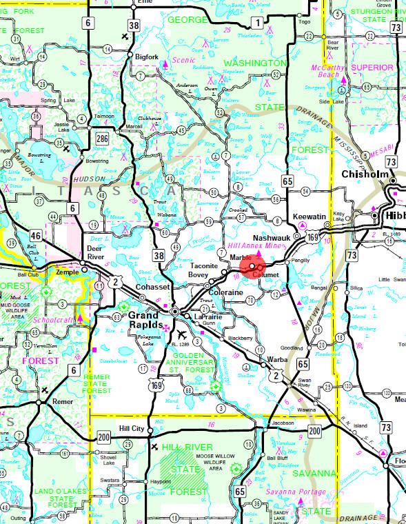
Minnesota State
Highway Map of the Marble Minnesota area
Events:
Attractions:
Recreation:
|
Mesabi Trail
 The
Taconite State Trail stretches 165 miles from Grand Rapids to Ely
and intersects with the Arrowhead State Trail just west of Lake
Vermillion. Portions are paved for biking and in-line skating. The
remainder of the natural surface trail is used primarily for
snowmobiling in the winter. The trail goes through a few areas that
have standing water in the summer, however portions of the trail are
suitable for horseback riding, hiking, and mountain biking. The
Taconite State Trail stretches 165 miles from Grand Rapids to Ely
and intersects with the Arrowhead State Trail just west of Lake
Vermillion. Portions are paved for biking and in-line skating. The
remainder of the natural surface trail is used primarily for
snowmobiling in the winter. The trail goes through a few areas that
have standing water in the summer, however portions of the trail are
suitable for horseback riding, hiking, and mountain biking.
The Taconite Trail winds through forests of birch
and aspen intertwined with pine, leading the visitor by many
isolated lakes and streams. From Grand Rapids heading north, you see
the impact of the taconite and iron mining industry. The northern
portion of the trail terrain is rolling and tree covered as it winds
through state and national forest land. Eight trail waysides and picnic facilities offer
scenic vistas of the hills, lakes and rivers of this area. The trail
also links three state parks: Bear Head Lake, Soudan Underground
Mine, and McCarthy Beach. The landscape in and around Bear Head Lake
State Park is very rolling and rocky. |
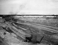
Arcturus open pit mine, Marble, 1942 |
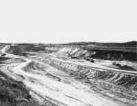
Gross-Marble open pit at Marble, 1942 |
|
Health Care:
Schools:
Churches:
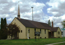
Grace English Lutheran
Church
200 Ethel Street
Marble, MN 55764
Phone:
(218) 247-7407
Pastor: n/a
Sunday
Worship: n/a |
|
St. Mary's Catholic
Church
500 Alice Avenue
Marble, MN 55764
Phone:
(218) 247-7368
CLOSED |
 |
Trout Lake Apostolic
Lutheran Church
Marble, MN 55764
Phone:
((218) 247-7843
Pastor: Harry Clemetti
Sunday Worship: n/a |
|
Media:
|
served by Iron Range media |
Motels:
Resorts:
Campgrounds:
Business Directory:
A-Z Electric
200 South Avenue
Marble, MN 55764
Phone:
(218) 247-7253 |
|
Eck Designs
200 Harriet Street
Marble, MN 55764
Phone:
(218) 247-0319
Web:
www.eckdesigns.com
Eck Designs LLC is a creative sign company that produces unique,
eye-catching signage for your business or event. We put quality
and experience in every project; earning us a reputation as an
inspired, reliable source for your sign needs. We make the
perfect signs to advertise your products or inform your
customers while keeping your company image in mind. |
|
Greenway Senior Citizen Club
107 Alice Avenue
Marble, MN 55764
Phone:
(218) 247-7206 |
|
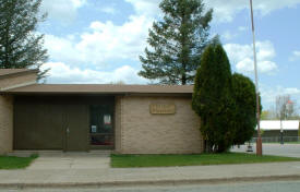
Greenway Township Office
300 Alice Avenue
Marble, MN 55764
Phone:
((218) 247-7318 |
 |
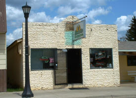
Hannibal's Pub
209 Alice Avenue
Marble, MN 55764
Phone:
(218) 247-7214
|
 |
Marble City Clerks Office
302 Alice Avenue
Marble, MN 55764
Phone:
(218) 247-7576 |
|
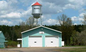
Marble Fire Department
Marble, MN 55764
Phone: n/a |
 |
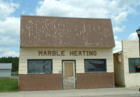
Marble Heating
Marble, MN 55764
PPhone: n/a |
 |
Marble Public Library
305 Alice Avenue
PO Box 409
Marble, MN 55764-0409
Phone:
(218) 247-7676
|
|
Midland Research Center
202 Alice Avenue
Marble, MN 55764
Phone:
(218) 247-7351 |
|
Rychart
Drywall Services
600 Alice Avenue
Marble, MN 55764
Phone:
(218)
247-0015 |
|
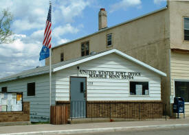
US Post Office
109 Alice Avenue
Marble, MN 55764-5000
Phone: (218) 247-7986 |
 |
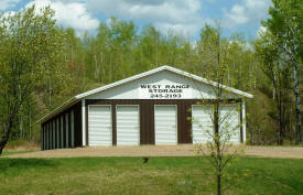
West Range Storage
Marble, MN 55764
Phone: (218) 244-8432
Web:
www.westrangestorage.com
At
West Range Storage, our Marble location, we have FOUR convenient
sizes for your recreational equipment, household storage,
hobbies and business needs. Why put off what you can do today?
Contact us and we’ll find a home for your valuables! |
 |
Aerial Photo:
Topographic Map:
[click map to enlarge, zoom in or zoom out]
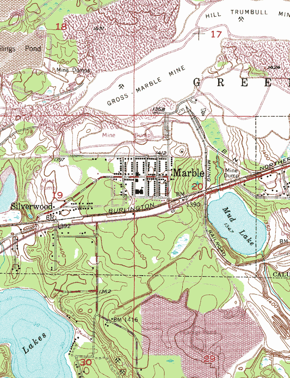 Topographic map is courtesy of the Minnesota DNR - click map to zoom or enlarge
|
|


