|
Navigation
LakesnWoods.com
Home
Page
Contact Us
Privacy
Pennington Guide:
Photo Gallery
Location
Geography
Demographics
History
Government
Post Office
News
Weather
Street Map
Events
Attractions
Recreation
Lakes
Health Care
Schools
Churches
Media
Motels
Resorts
Campgrounds
Businesses
Aerial Photo
Topographic Map © 2004-2025
LakesnWoods LLC
All Rights Reserved
DCMA, Defamation, Copyright and Trademark Infingement Policy
|
WANTED! Do you have photos, historical accounts or
other items pertaining to the Pennington area? Would you like to
share this historical information with the world?
LakesnWoods.com would like to publish your Pennington photos
(current or historical) or historical accounts on this website.
Original materials can be returned and your privacy will be
respected.
Contact us |
|
Pennington Minnesota Community Guide
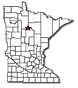
Location:
|
Pennington, Minnesota (population 52) is located near the
northeastern edge of Cass Lake, just 2 or 3 miles north of where
the Mississippi River leaves the lake wending it's way to the
Gulf of Mexico. |
 |
Population:
Brook Lake
unorganized territory |
1970 |
1980 |
1990 |
2000 |
1990-2000
Change |
| Actual |
Percent |
| Population |
145 |
183 |
176 |
200 |
24 |
13.64 |
| Land Area (sq. mile) |
25.40 |
35.90 |
25.32 |
25.31 |
-0.01 |
-0.02 |
| Density (persons per sq. mile) |
5.71 |
5.10 |
6.95 |
7.90 |
0.95 |
13.66 |
| Housing Units |
89 |
186 |
119 |
180 |
61 |
51.26 |
| Households |
-- |
66 |
65 |
79 |
14 |
21.54 |
| Persons Per Household |
-- |
2.77 |
2.71 |
2.53 |
-0.18 |
-6.56 |
Geography:
According to the United States Census Bureau, the
unorganized territory has a total area of 36.3 square miles (94.0 km²),
of which, 25.3 square miles (65.6 km²) of it is land and 11.0 square
miles (28.4 km²) of it (30.26%) is water.
From
Wikipedia, the free encyclopedia.
Demographics:
History:
PENNINGTON, an unincorporated village in Brook Lake
Township, section 4; its post office was established in 1911. Courtesy
Minnesota Historical Society
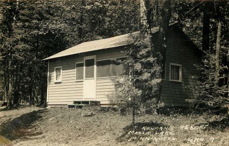
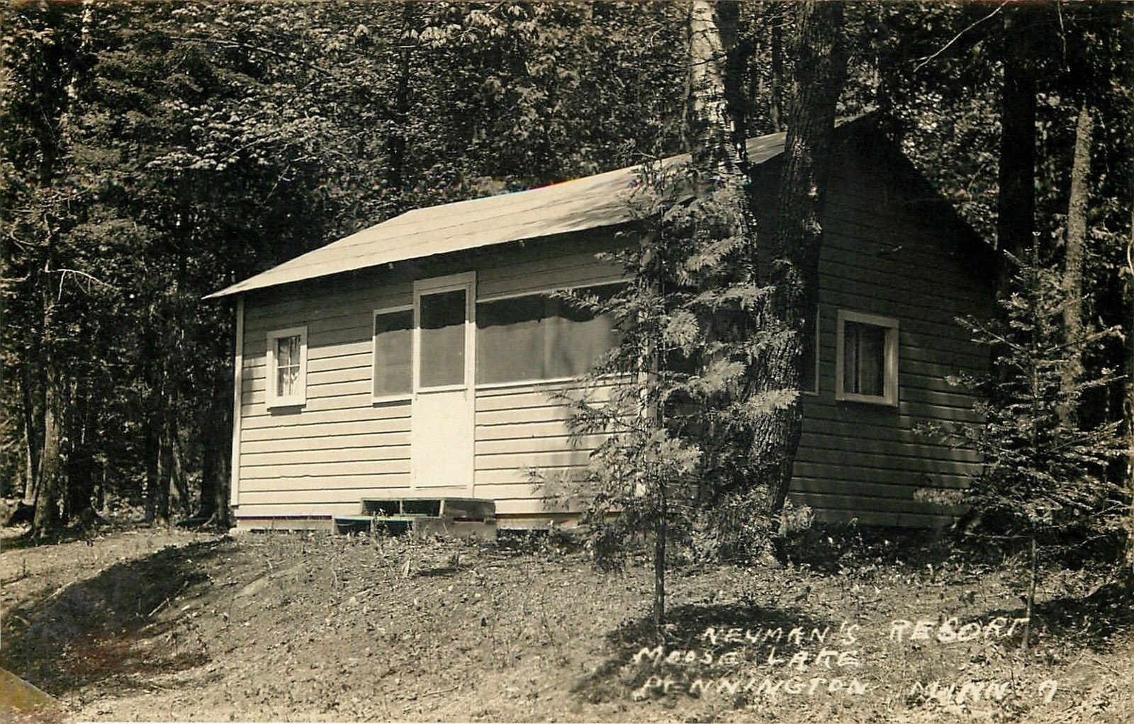
Cabin at Neuman's Resort on Moose Lake,
Pennington Minnesota, 1950s
LakesnWoods.com Postcard and Postcard Image Collection - click to enlarge |
Government:
Post Office:
News:
Weather:
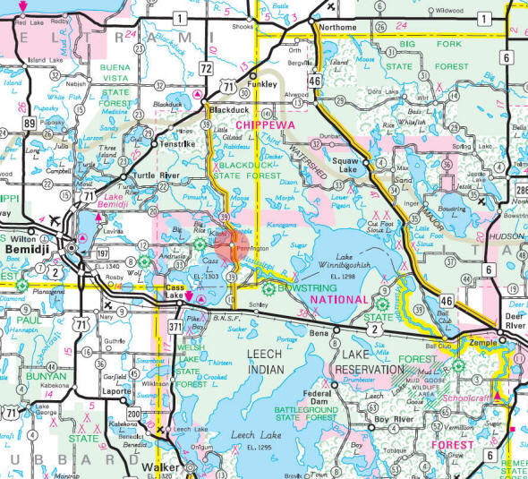
Map:
Events:
|
Pennington
Music Festival |
Last
weekend in July |
The
Pennington Music Festival is held in the heart of Chippewa
National Forest and has been an annual event since 1998. Besides
the Flathead Cats, performers have been Big Brother and Holding,
Leo Kottke, "Spider" John Koerner and Dave "Snaker" Ray, City
Mouse, Ross William Perry and the Dukes of Hubbard.
|
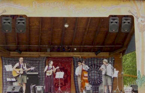
Flathead Cats; Pennington
Music Festival, July 26, 2003 |
|
Attractions:
Recreation:
Lakes:
Health
Care:
Schools:
Churches:
Media:
|
See Bemidji and Cass Lake |
Motels:
Resorts:
Chippewa Paws Resort
27418 Chippewa Paws Lane NW
Pennington, MN 56663-9701
Phone: (218) 335- 6897
Toll Free: (800) 701-6897
Web: www.chippewapaws.com
Chippewa Paws Resort is tucked away on the northeast shore of
beautiful Cass Lake, MN in the heart of the Chippewa National
Forest. Our resort, commonly called "The Paws" is a quiet
hideaway. |
 |
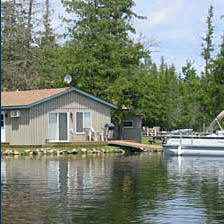
Paradise Resort
8677 Moose Lake Rd N.E.
Pennington, MN 56663
Phone: (218) 835-6514
Toll Free: (800) 845-9124
Web:
www.paradiseresort.com
Paradise Resort is located near Bemidji and Grand Rapids on
beautiful Moose Lake in the majestic Chippewa National Forest.
Discover the peaceful tranquility and pristine northwoods beauty
at our quiet, secluded family resort.
Our 11 lakeside cabins and RV sites are positioned to offer
fantastic southern exposure and are spaced for privacy at the
waters edge. Explore our resort activities or visit attractions
in the area like the famous Itasca State Park which is a short
drive away. |

 |
Campgrounds:
Businesses:
Aerial Photo:
Aerial photo is courtesy of the Minnesota DNR
-
click map to zoom or enlarge
Topographic Map:
[click map to enlarge, zoom in or zoom out]
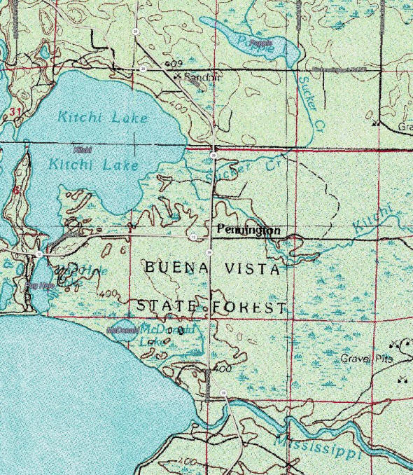 Topographic map is courtesy of the Minnesota DNR
-
click map to zoom or enlarge
Topographic map is courtesy of the Minnesota DNR
-
click map to zoom or enlarge
|
|