|
|
|
|
|
|
Navigation
LakesnWoods.com
© 2004-2025 DCMA, Defamation, Copyright and Trademark Infingement Policy
|
|
|||||||||||||||||||||||||||||||||||||||||||||||||||||||||||||||||||||||||||||||||||||||||||||||||||||||||||||||||||||||||||||||||||||||||||||||||||||||||||||||||||||||||||||||||||||||||||||
 |
 |
| Rock Creek (city) | 1970 | 1980 | 1990 | 2000 | 2010 | 2000-2010 Change | |
|---|---|---|---|---|---|---|---|
| Actual | Percent | ||||||
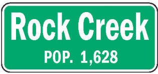
| Population | 815 | 890 | 1,040 | 1,119 | 1,628 | +509 | +45.49 |
| Land Area (sq. mile) | 44.00 | 42.44 | 42.98 | 42.97 | 42.97 | 0 | 0.00 |
| Density (persons per sq. mile) | 18.5 | 21.0 | 24.2 | 26.0 | 37.9 | +11.89 | +45.49 |
| Housing Units | 256 | 339 | 369 | 417 | 635 | +218 | +52.28 |
| Households | -- | 282 | 319 | 389 | 582 | +193 | +49.61 |
| Persons Per Household | -- | 3.16 | 3.26 | 2.88 | 2.80 | -0.08 | -2.78 |
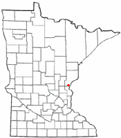
Rock Creek is a city in Pine County, Minnesota. Interstate 35 and Minnesota State Highway 70 are two of the main routes in the community. According to the United States Census Bureau, the city has a total area of 43.32 square miles (112.20 km2), of which 43.01 square miles (111.40 km2) is land and 0.31 square miles (0.80 km2) is water. It is by far the largest city by area in Pine County. The elevation is 938 ft (286 m) above sea level.
From Wikipedia, the free encyclopedia
As of the census of 2010, there were 1,628 people, 582 households, and 441 families residing in the city. The population density was 37.9 inhabitants per square mile (14.6/km2). There were 635 housing units at an average density of 14.8 per square mile (5.7/km2). The racial makeup of the city was 97.0% White, 0.4% African American, 0.7% Native American, 0.6% Asian, 0.1% from other races, and 1.2% from two or more races. Hispanic or Latino of any race were 1.1% of the population.
There were 582 households of which 36.3% had children under the age of 18 living with them, 61.9% were married couples living together, 7.0% had a female householder with no husband present, 6.9% had a male householder with no wife present, and 24.2% were non-families. 17.2% of all households were made up of individuals and 5.2% had someone living alone who was 65 years of age or older. The average household size was 2.76 and the average family size was 3.05.
The median age in the city was 39.1 years. 25.6% of residents were under the age of 18; 7.1% were between the ages of 18 and 24; 26.1% were from 25 to 44; 30.4% were from 45 to 64; and 10.7% were 65 years of age or older. The gender makeup of the city was 52.6% male and 47.4% female.
Visit The
Minnesota History Shop! |
ROCK CREEK Township, settled in 1872, organized March 2, 1874, and its city in section 22, bear the name of the creek that here flows south into the northeast corner of Chisago County, tributary to the St. Croix River. The city was incorporated as a village on November 4, 1970; it was established soon after the Lake Superior and Mississippi Railroad built through the area in 1870 and was a lumbering and sawmill center, having five mills in the area. The post office began in 1874; its name was Rockcreek, 1894-1950.
Courtesy Minnesota Historical Society
|
Rock Creek City Hall 7080 State Highway 70 PO Box 229 Rock Creek, MN 55067 Phone: (320) 629-2736 Fax: (320) 629-8934
Regular Business Hours:
City Council Meetings:
|
||||
| Title | Term Ends | Name and Address | Phone | |
| Mayor | 12/31/2022 | Dick Johnson 10020 560th Street Pine City, MN 55063 |
(320) 298-0176 | |
| Administrator | appointed | Sandra Pangerl PO Box 229 Rock Creek, MN 55067 |
 |
(320) 629-2736 |
| Treasurer | appointed | Nancy Runyan PO Box 229 Rock Creek, MN 55067 |
|
(320) 629-2736 |
| Council Member | 12/31/2022 | Dan Saumer 5161 State Highway 70 Pine City, MN 55063 |
(320) 364-3698 | |
| Council Member | 12/31/2022 | Josiah (Joe) Babolik
55777 Government Road Rush City, MN 55069 |
(763) 227-7733 | |
| Council Member | 12/31/2024 | Ronnie Berdan 5496 550th Street Pine City, MN 55063 |
(320) 358-3203 | |
| Council Member | 12/31/2024 | Don Ramberg 55535 Fairfield Avenue Rush City, MN 55069 |
(320) 438-9318 | |
|
Post Office closed in
1950 |
| Utility Type | Utility Name | Utility Phone |
| Electricity | (800) 254-7944 | |
| Natural Gas | n/a | -- |
| Wastewater | n/a | -- |
| Water | n/a | -- |
| Telephone | CenturyLink Communications | (800) 244-1111 |
| Cable TV | n/a | -- |
| Employer | Products/Services | Employees |
| not available | ||
|
|
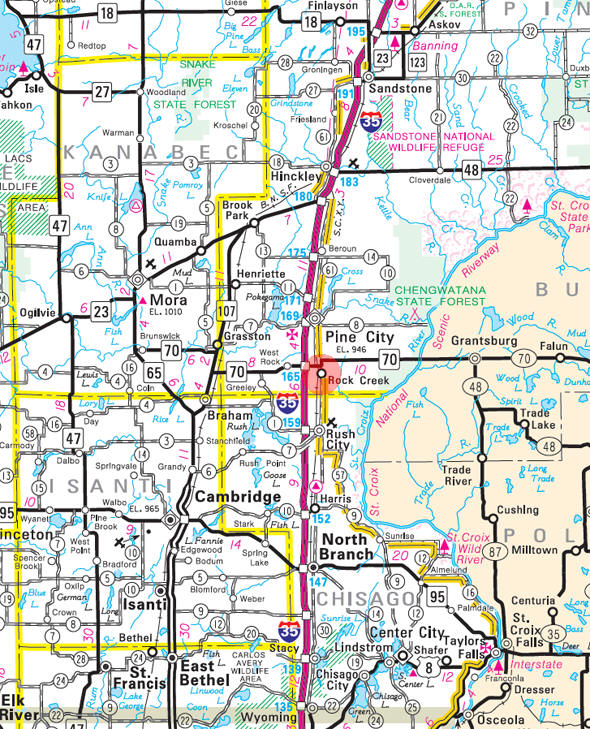
Minnesota State
Highway Map of the Rock Creek Minnesota area
|
none |
Check Out
The Minnesota
History Shop! Good Goods and
Great Gifts! |
|
none |
|
none |
| Lake Name | Size (acres) |
Lake info | Lake Map | Rec Map | Topo Map |
|---|---|---|---|---|---|
| none in the immediate area | |||||
|
none |
|
none |
| Local | |
| Metro | |
|
see the Twin Cities Media Guide page for Twin Cities metro area newspapers, radio and TV |
|
|
none |
|
none |
|
|
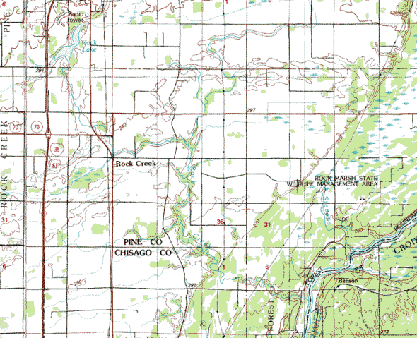
Topographic map is courtesy of the Minnesota DNR
-
click map to zoom or enlarge
|
|
|
|
|||
|
|
© 2004-2025 LakesnWoods LLC All Rights Reserved |
|
|
|
|
|||