|
|
|
|
|
|
Navigation
LakesnWoods.com © 2004-2025 DCMA, Defamation, Copyright and Trademark Infingement Policy
|
|
|||||||||||||||||||||||||||||||||||||||||||||||||||||||||||||||||||||||||||||||||||||||||||||||||||||||||||||||||||||||||||||||||||||||||||||||||||||||||||||||||||||||||||||||||||||||||||||||||||
 |
 |
| Rushford Village (city) | 1970 | 1980 | 1990 | 2000 | 2010 | 2000-2010 Change | |
|---|---|---|---|---|---|---|---|
| Actual | Percent | ||||||
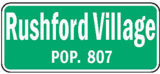
| Population | 601 | 688 | 705 | 714 | 807 | +93 | +13.03 |
| Land Area (sq. mile) | 33.00 | 33.41 | 33.52 | 33.41 | 33.41 | 0 | 0.00 |
| Density (persons per sq. mile) | 18.21 | 20.59 | 21.03 | 21.37 | 24.15 | +2.78 | +13.03 |
| Housing Units | 196 | 236 | 237 | 279 | 325 | +46 | +16.49 |
| Households | -- | 224 | 219 | 264 | 305 | +41 | +15.53 |
| Persons Per Household | -- | 3.07 | 2.77 | 2.70 | 2.65 | -0.05 | -1.85 |
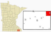
Rushford Village is a city in Fillmore County Minnesota. According to the United States Census Bureau, the city has a total area of 33.64 square miles (87.13 km2), of which 33.42 square miles (86.56 km2) is land and 0.22 square miles (0.57 km2) is water. The elevation is 741 ft (226 m) above sea level.
From Wikipedia, the free encyclopedia.
As of the census of 2010, there were 807 people, 305 households, and 250 families residing in the city. The population density was 24.1 inhabitants per square mile (9.3/km2). There were 325 housing units at an average density of 9.7 per square mile (3.7/km2). The racial makeup of the city was 99.0% White, 0.1% African American, 0.1% Asian, and 0.7% from two or more races. Hispanic or Latino of any race were 0.6% of the population.
There were 305 households of which 33.1% had children under the age of 18 living with them, 73.1% were married couples living together, 4.3% had a female householder with no husband present, 4.6% had a male householder with no wife present, and 18.0% were non-families. 14.8% of all households were made up of individuals and 8.9% had someone living alone who was 65 years of age or older. The average household size was 2.65 and the average family size was 2.91.
The median age in the city was 43.5 years. 23.7% of residents were under the age of 18; 7.1% were between the ages of 18 and 24; 21.1% were from 25 to 44; 30.7% were from 45 to 64; and 17.3% were 65 years of age or older. The gender makeup of the city was 49.9% male and 50.1% female.
Visit The
Minnesota History Shop! |
Courtesy Minnesota Historical Society
|
Rushford Village City Hall 43038 State Highway 30 Rushford Village, MN 55971-5167 Phone: (507) 864-7974 Regular Business Hours: Monday and Friday 9:00am - Noon Tuesday 3:00 pm - 6:00 pm All other times by Appointment call 864-7974 


 |
||||
| Title | Term Ends | Name and Address | Phone | |
| Mayor | 12/31/2022 |
Dennis Overland 30269 Main Street Rushford Village, MN 55971 |
|
(507) 864-2433 |
| Clerk/Treasurer | appointed | Mary Miner 43038 State Hwy 30 Rushford Village, MN 55962 |
|
(507) 864-7974 |
| Council Member | 12/31/2022 | Roger Knutson 44578 Oakview Loop Rushford Village, MN 55971 |
(507) 864-3621 | |
| Council Member | 12/31/2022 | Robert Hart 44570 Pine Lane Rushford Village, MN 55971 |
(507) 864-2810 | |
| Council Member | 12/31/2024 | Rick Ruberg 41568 Ridgeview Road Rushford Village, MN 55971 |
(507)
458-1022 (507) 864-7838 |
|
| Council Member | 12/31/2024 |
Michael Ebner 32833 Rush Creek Road Rushford Village, MN 55962 |
|
(507) 864-7206 |
|
US Post Office 501 S Mill Street Rushford, MN 55971-8841 Phone: (507) 864-7169 Toll Free: (800) ASK-USPS Regular Business Hours:
|
 |
| Utility Type | Utility Name | Utility Phone |
| Electricity | MiEnergy Cooperative | (800) 432-2285 |
| Natural Gas | Peoples Natural Gas | (800) 891-0890 |
| Wastewater | Rushford Village Municipal | (507) 864-7974 |
| Water | Rushford Village Municipal | (507) 864-7974 |
| Telephone | Acentek | (507) 896-3192 |
| Cable TV | Acentek | (507) 896-3192 |
| Employer | Products/Services | Employees |
| n/a | ||
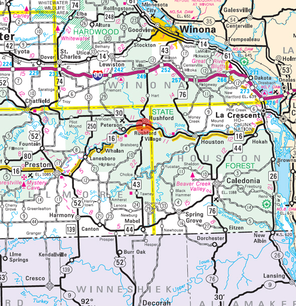
Minnesota
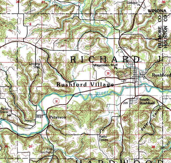
State Highway Map of the Rushford Village Minnesota area
| none |
| none |
| none |
| Lake Name | Size (acres) |
Lake info | Lake Map | Rec Map | Topo Map |
|---|---|---|---|---|---|
| none in the immediate area | |||||
| none |
| none |
| none |
| none |
| none |
| none |
| none |
|
|
|
|
© 2004-2025 LakesnWoods LLC All Rights Reserved |
|
|
|
||