

|
|
|
|
|
|
Navigation LakesnWoods.com © 2004-2022 DCMA, Defamation, Copyright and Trademark Infingement Policy
|
|
| pre-1880 | 1880s | 1890s | 1900s | 1910s | 1920s | 1930s |
| 1940s | 1950s | 1960s | 1970s | 1980s | 1990s | 2000s |
By Topic:
Hotels/Motels
Retail
Parks
Hospitals
Industry
Rail
Theaters
Schools
Churches
Maps
By Area:
Map of the City of St. Paul, Minnesota, 1852
Published by Miller &
Boyle's Lithographic
- Image courtesy
Library of Congress -
click image to enlarge
Map of St. Paul, Minnesota, 1867
Original lithograph from
Chicago Lithographing Co. - Image courtesy
Library of Congress -
click image to enlarge
Counting House Map of St. Paul, Minnesota, 1869
Published by Rice & Bell,
image courtesy of the
John
R. Borchert Map Library - click image to enlarge
Panoramic view of St. Paul, Minnesota, 1874
Published by A.T. Andreas
- - Image courtesy of David
Rumsey Historical Map Collection - click image to enlarge
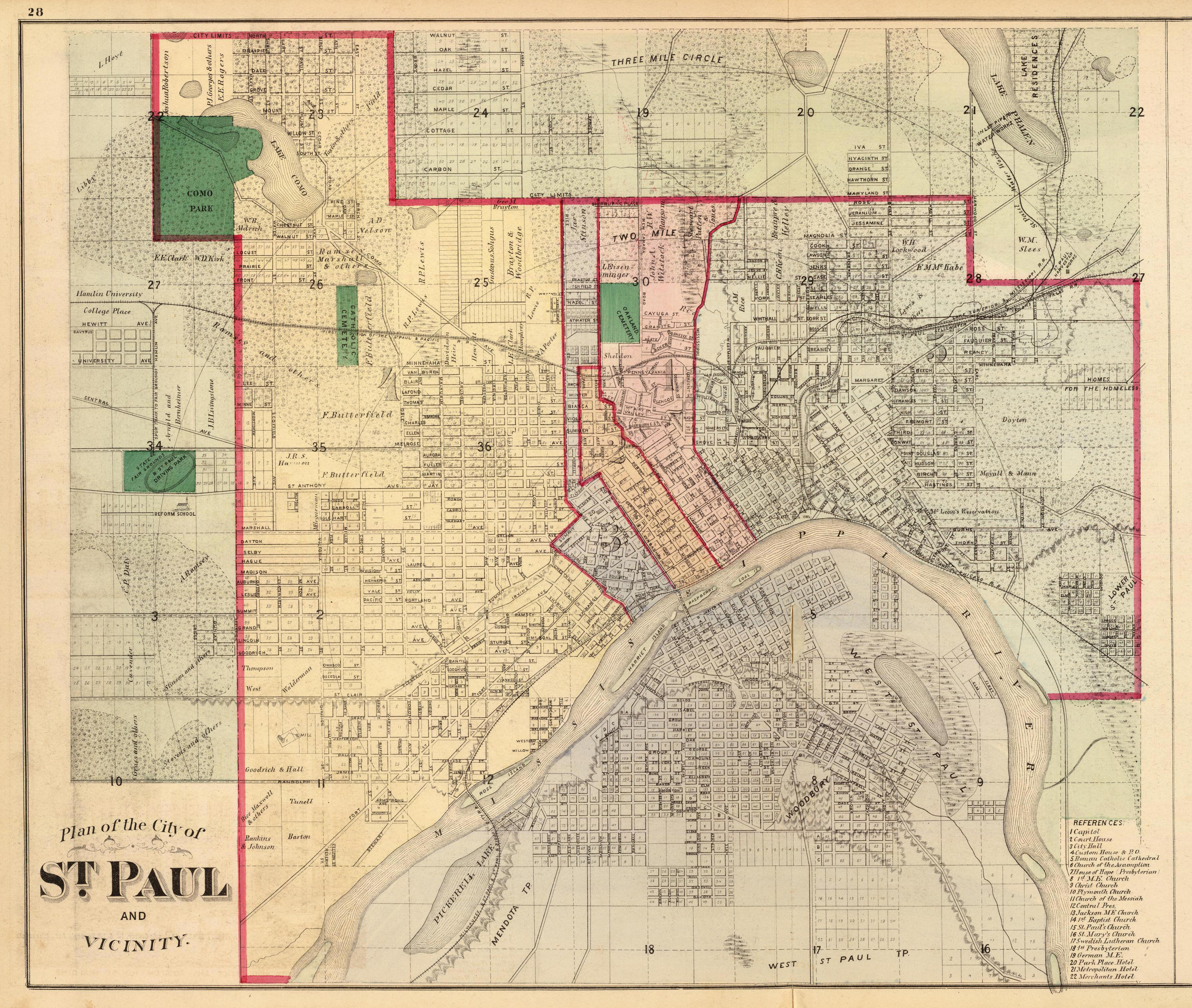
Plan of the City of St. Paul with Capitol, Reform School,
Post Office and Custom House, 1874
Published by A.T. Andreas
- - Image courtesy of David
Rumsey Historical Map Collection - click image to enlarge
Copies of this map are
available for sale on Amazon!
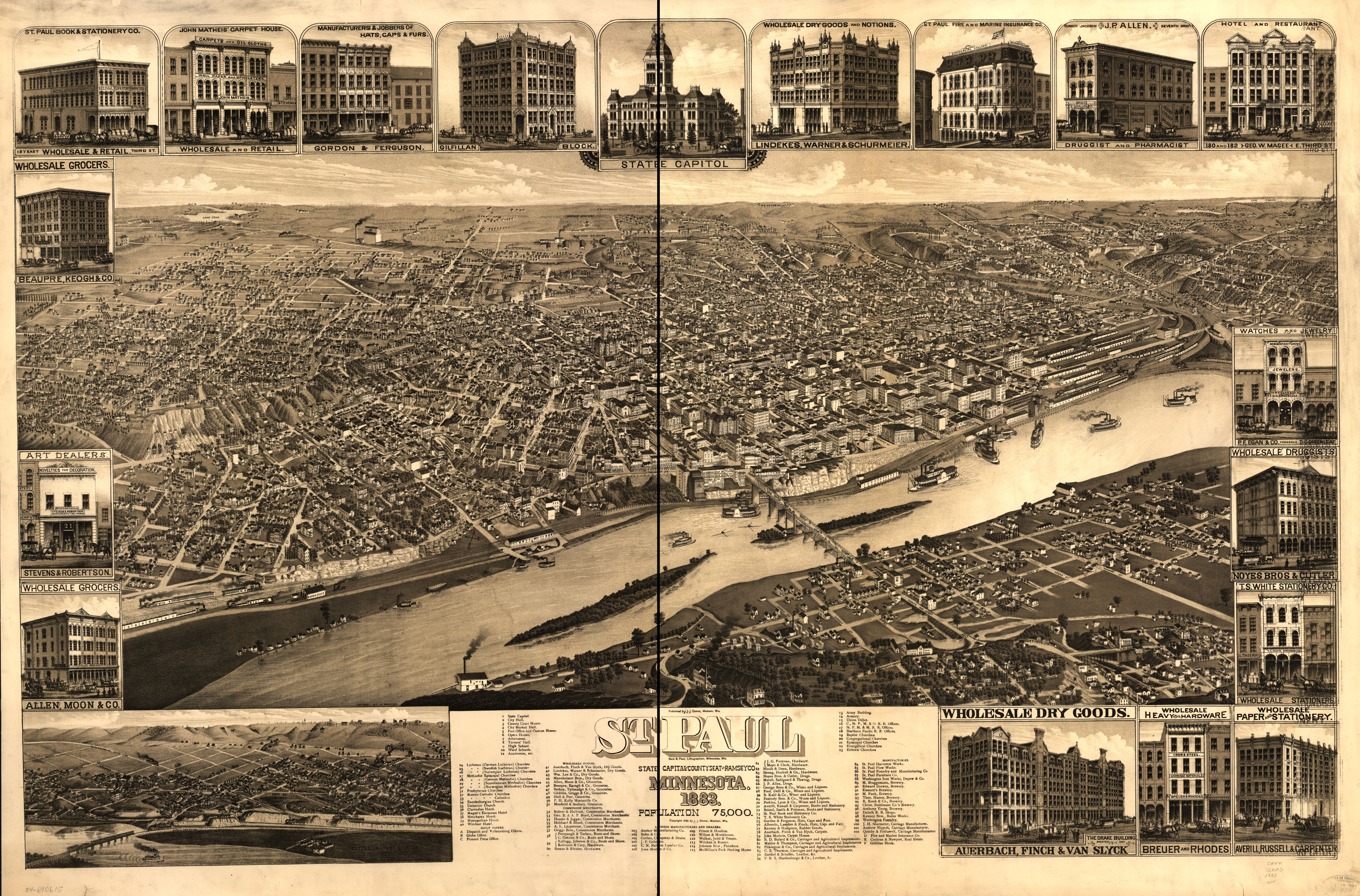
Birds eye view of St. Paul, Minnesota 1883
Published by J.J. Stoner,
image courtesy
Library of Congress -
click image to enlarge
Copies of this map are
available for sale on Amazon!
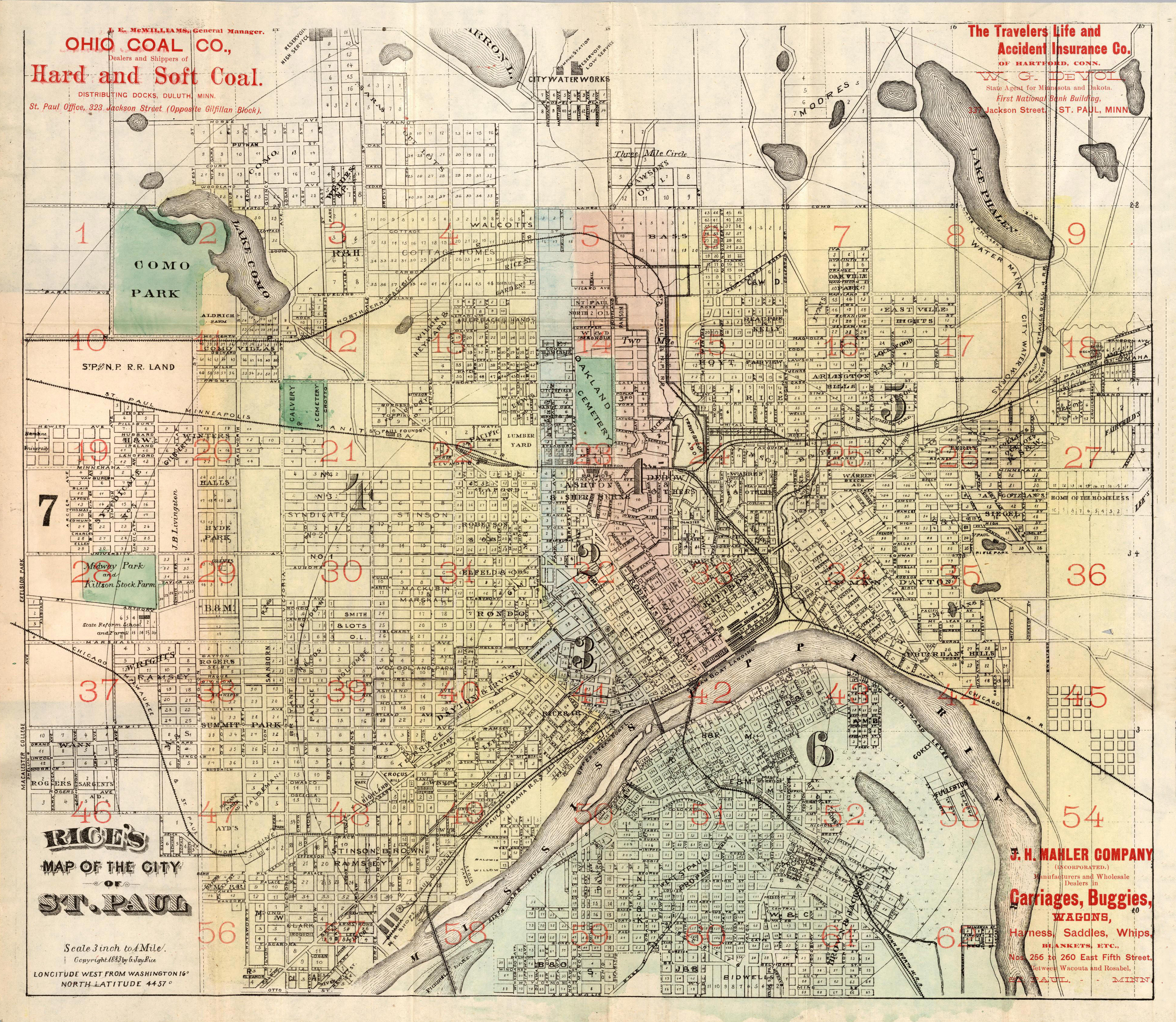
Rice's Map of The City of St. Paul, Minnesota, 1884
Published by Everett S.
Geer
- Image courtesy of David
Rumsey Historical Map Collection - click image to enlarge
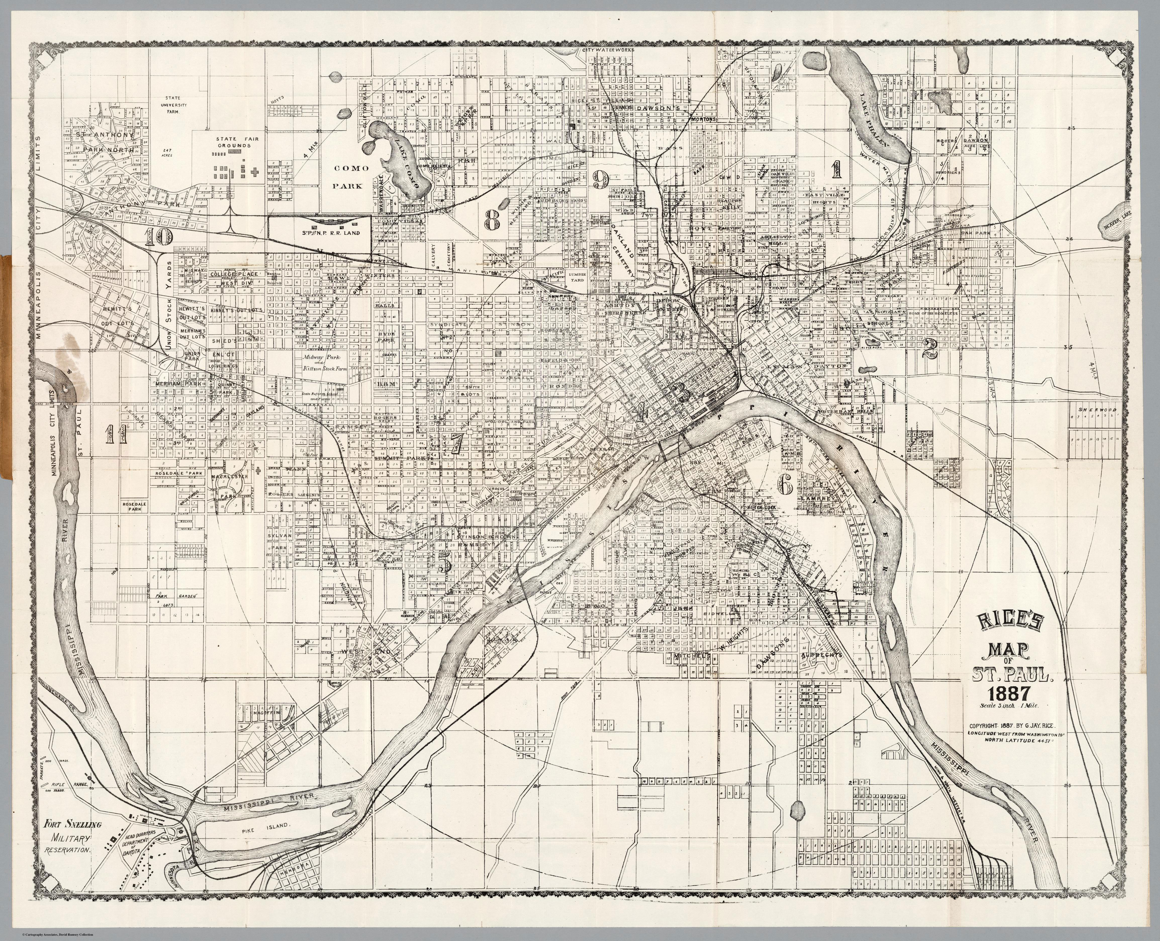
Map of St. Paul, Minnesota, 1887
Published by St. Paul
Litho. Eng. and Publishing Co.
- Image courtesy of David
Rumsey Historical Map Collection - click image to enlarge
Copies of this map are
available for sale on Amazon!
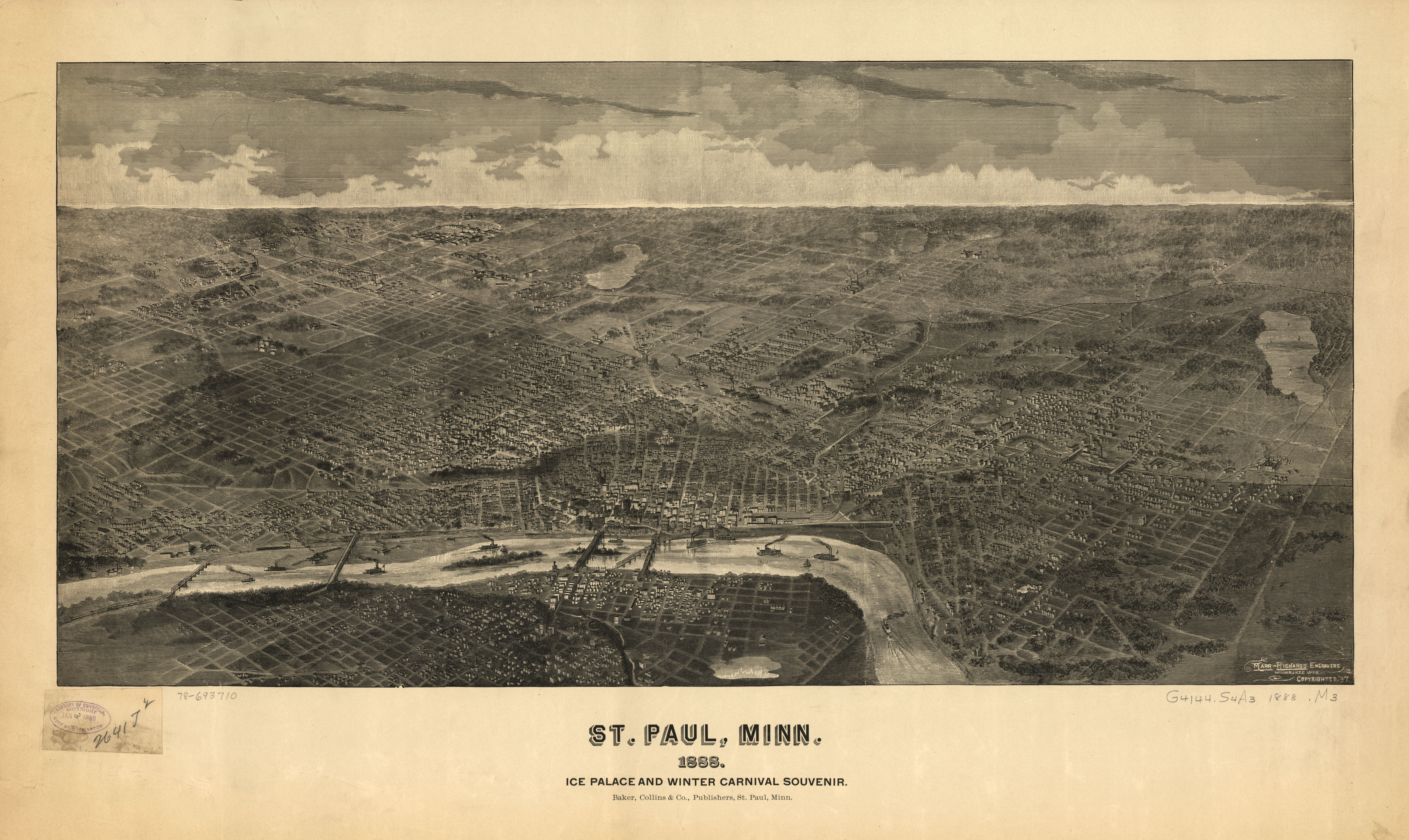
Ice palace and Winter Carnival souvenir map of St. Paul,
Minnesota, 1888
Published by Marr & Richards Engraving Co.
- Image courtesy
Library of Congress -
click image to enlarge
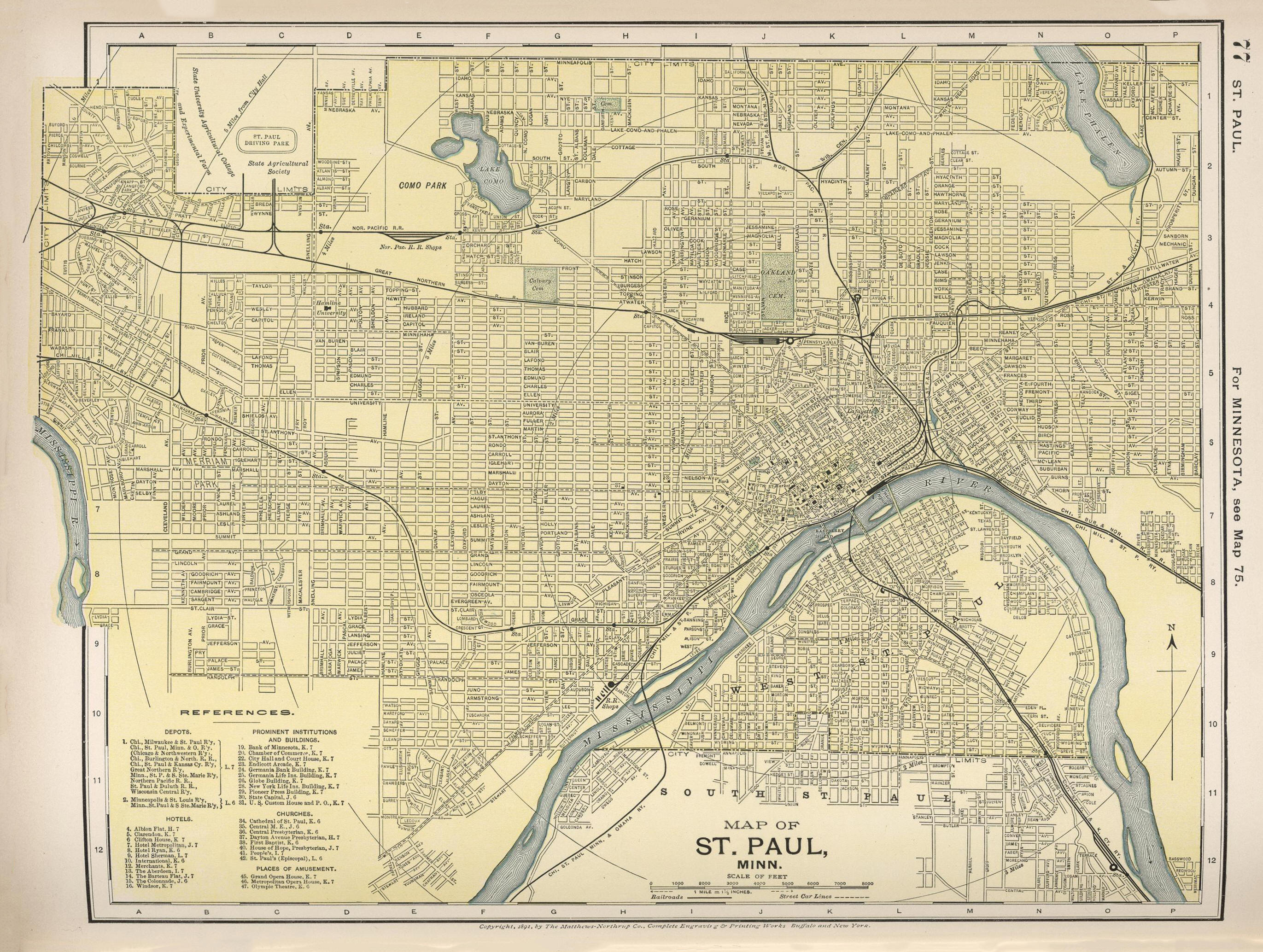
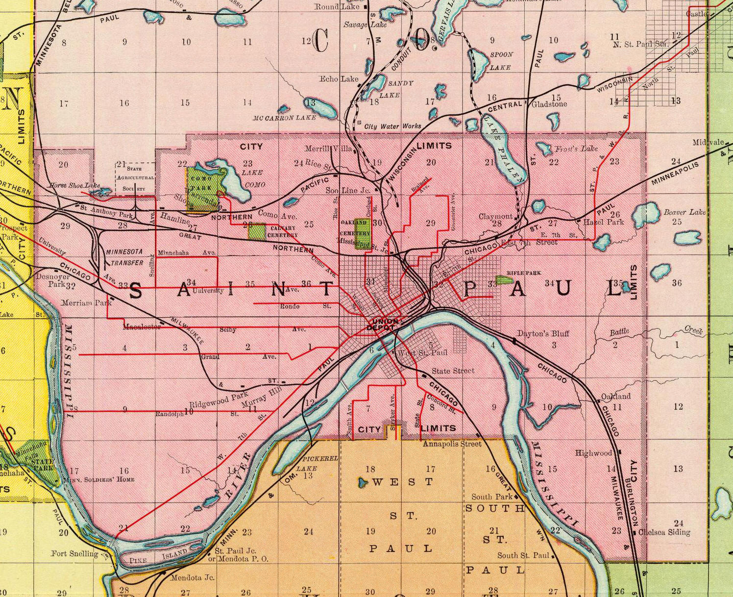
Map of St. Paul, Minnesota, 1891
Published by D. Appleton &
Co.-
Image courtesy of David
Rumsey Historical Map Collection - click image to enlarge
Copies of this map are
available for sale on Amazon!
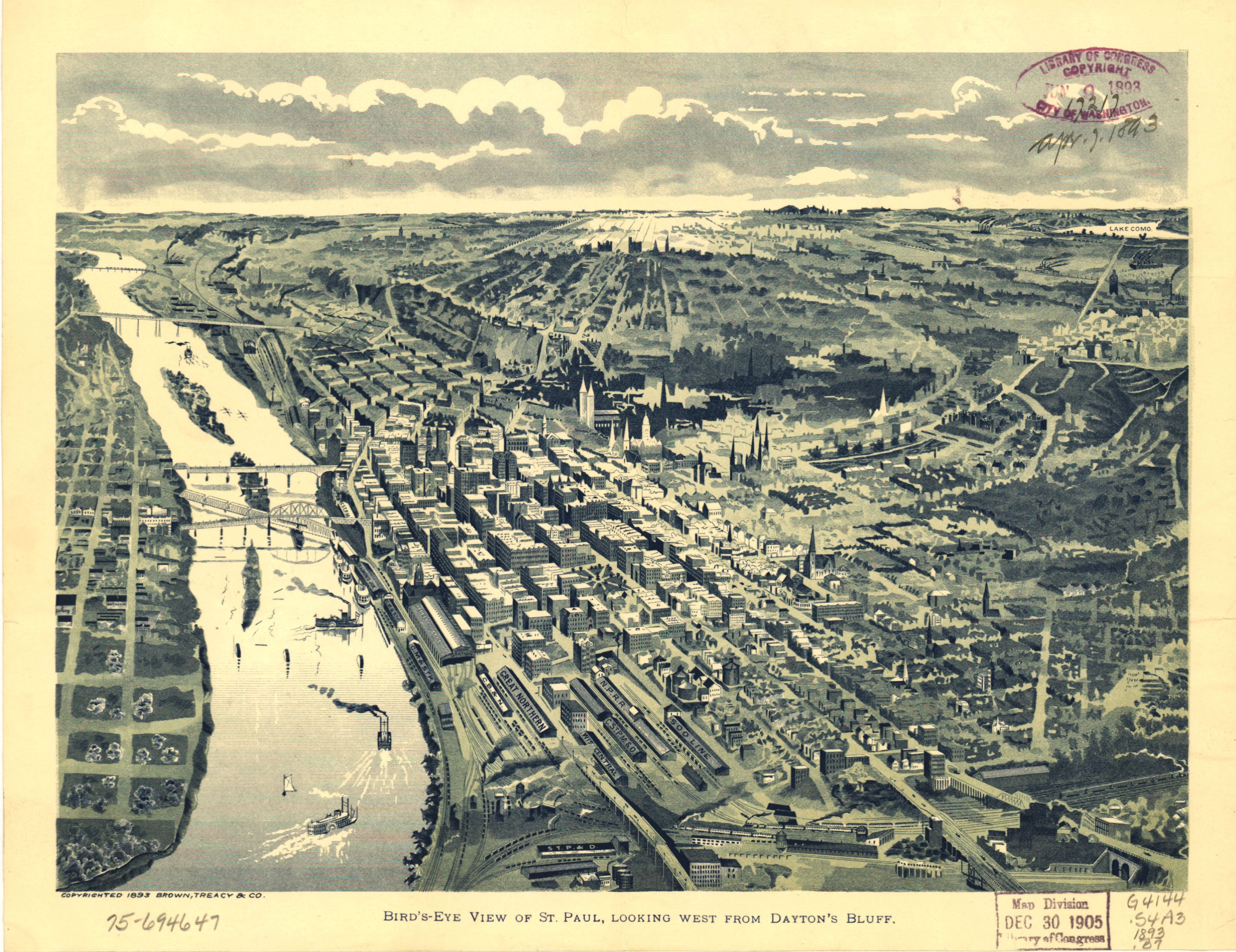
Bird's-eye view of St. Paul, looking west from Dayton's
Bluff, 1893
Published
by Brown, Treacy & Co. -
Image courtesy
Library of Congress -
click image to enlarge
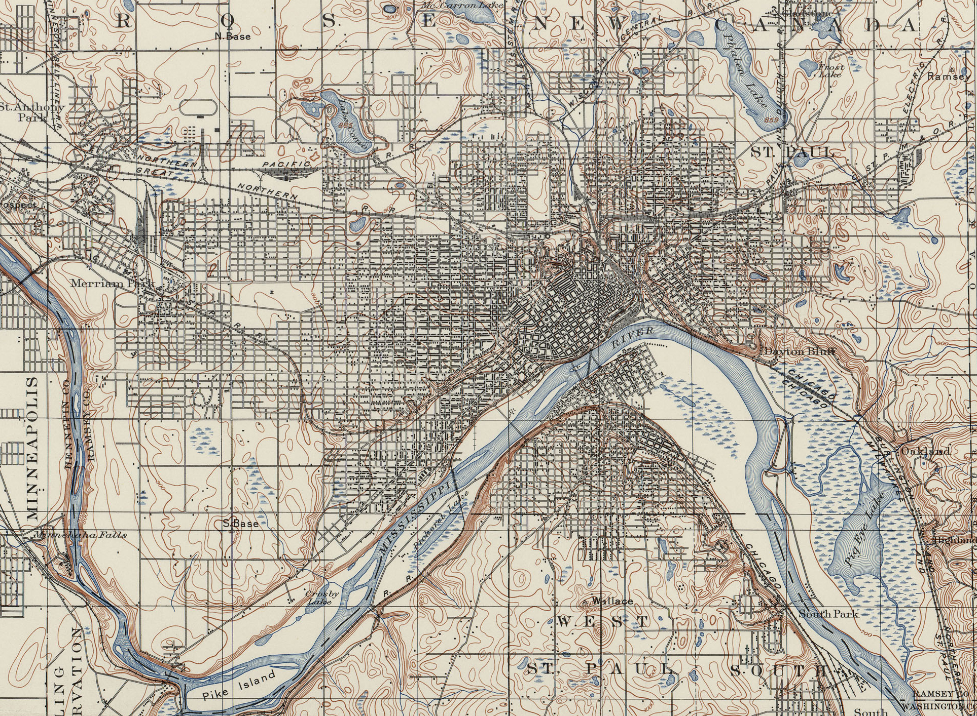
Topographic map of the St. Paul, Minnesota area, 1894
Published by the
U.S. Geological Survey,
image courtesy of
Perry-Castañeda Library - click image to enlarge
Map of the St. Paul, Minnesota area, includes trolley lines,
1897
Published by Rand
McNally -
Image courtesy of David
Rumsey Historical Map Collection - click image to enlarge
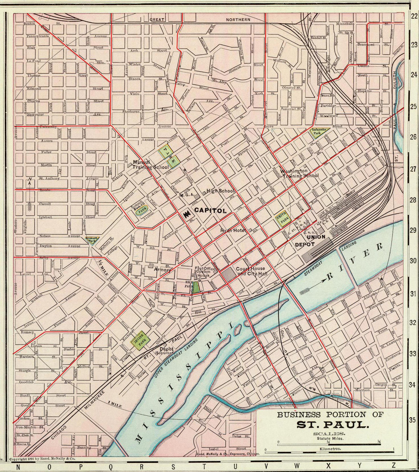
Map of the Downtown St. Paul, Minnesota area, includes
trolley lines, 1897
Published by Rand McNally
- Image courtesy of David
Rumsey Historical Map Collection - click image to enlarge
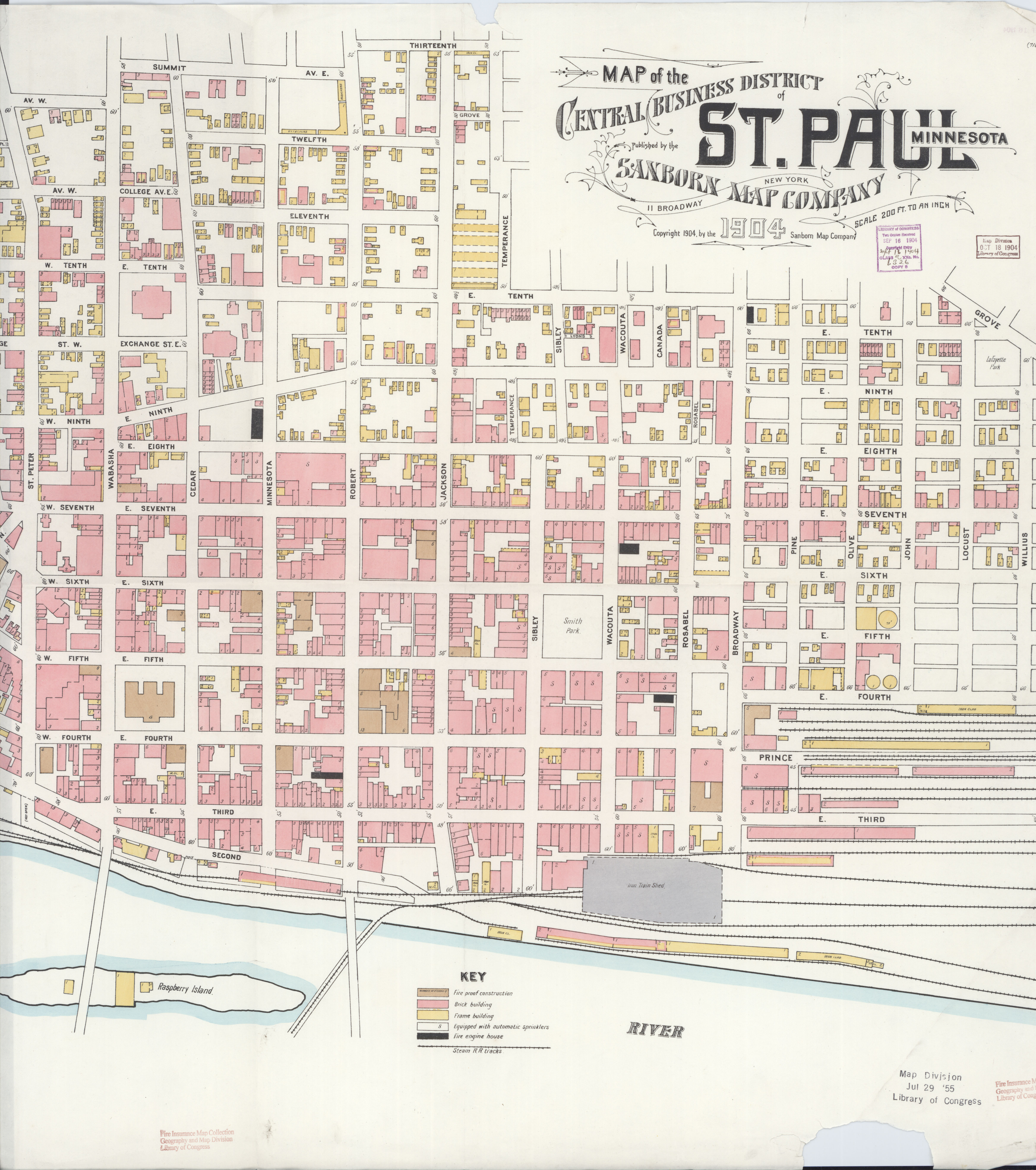
Sanborn Fire Insurance Map of Downtown St. Paul, Minnesota, 1904
- sheet 1
Published by Sanborn Map
Company
- Image courtesy
Library of Congress -
click image to enlarge

Sanborn Fire Insurance Map of Downtown St. Paul, Minnesota, 1904
- sheet 2
Published by Sanborn Map
Company - Image courtesy
Library of Congress -
click image to enlarge
1904 Sanborn Fire Insurance maps for
other areas of St. Paul are available at the Library of
Congress
Click here
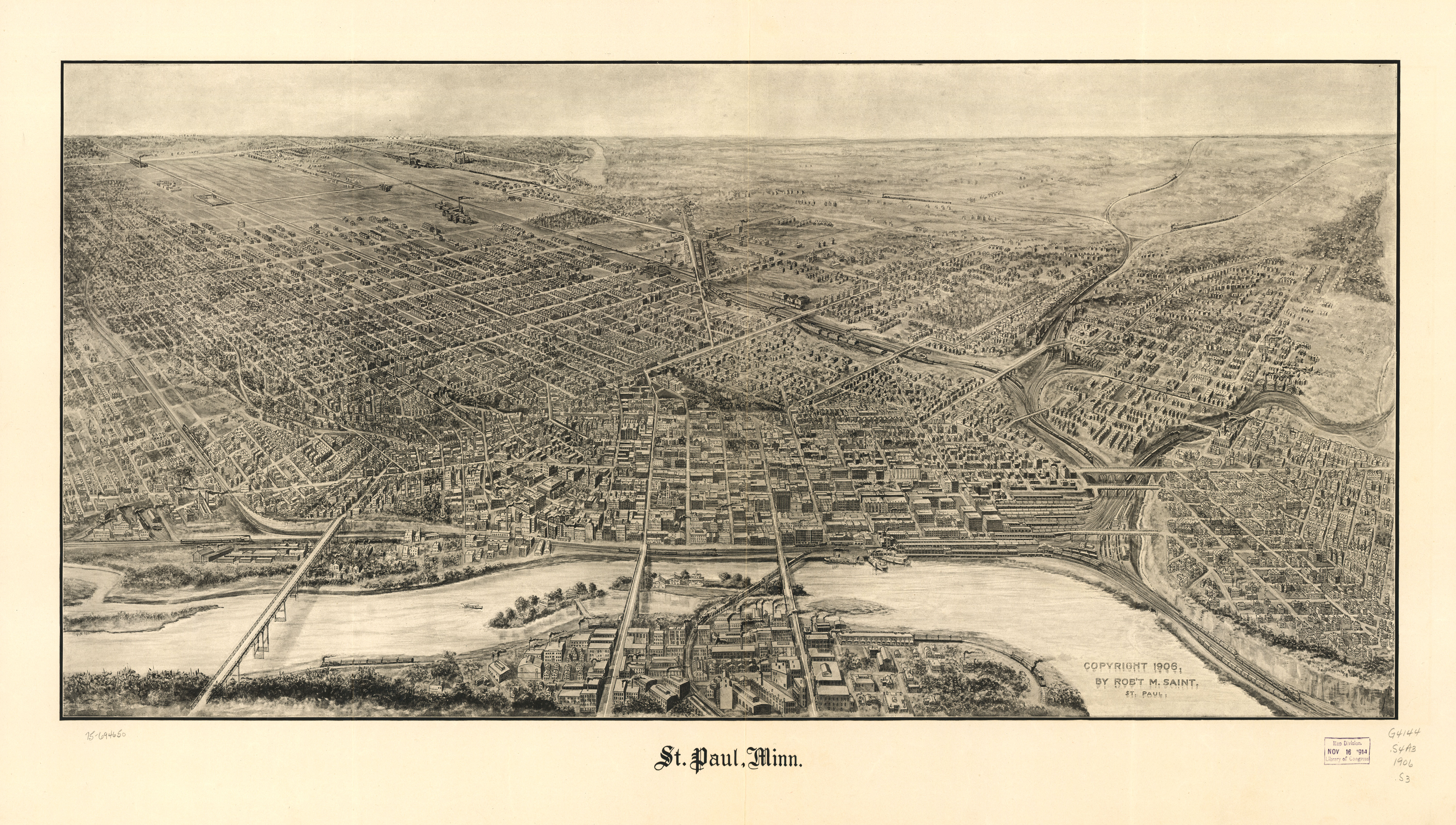
Panoramic view of St. Paul, Minnesota, 1906
Original by Robert M.
Saint,
image courtesy
Library of Congress -
click image to enlarge
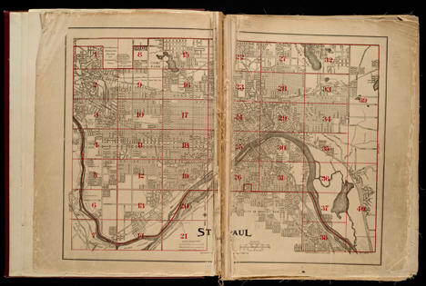
Curtice's Revised Atlas Map of the City of St. Paul,
Minnesota, 1908
Click on map to be taken to a
dynamic map, then click on the area you want to see the
detail of.
Resulting image will look like the sample
shown below showing details of each lot and building:
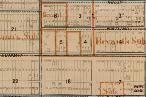
Published by D. L.
Curtice, image courtesy of the
John
R. Borchert Map Library - click image to enlarge
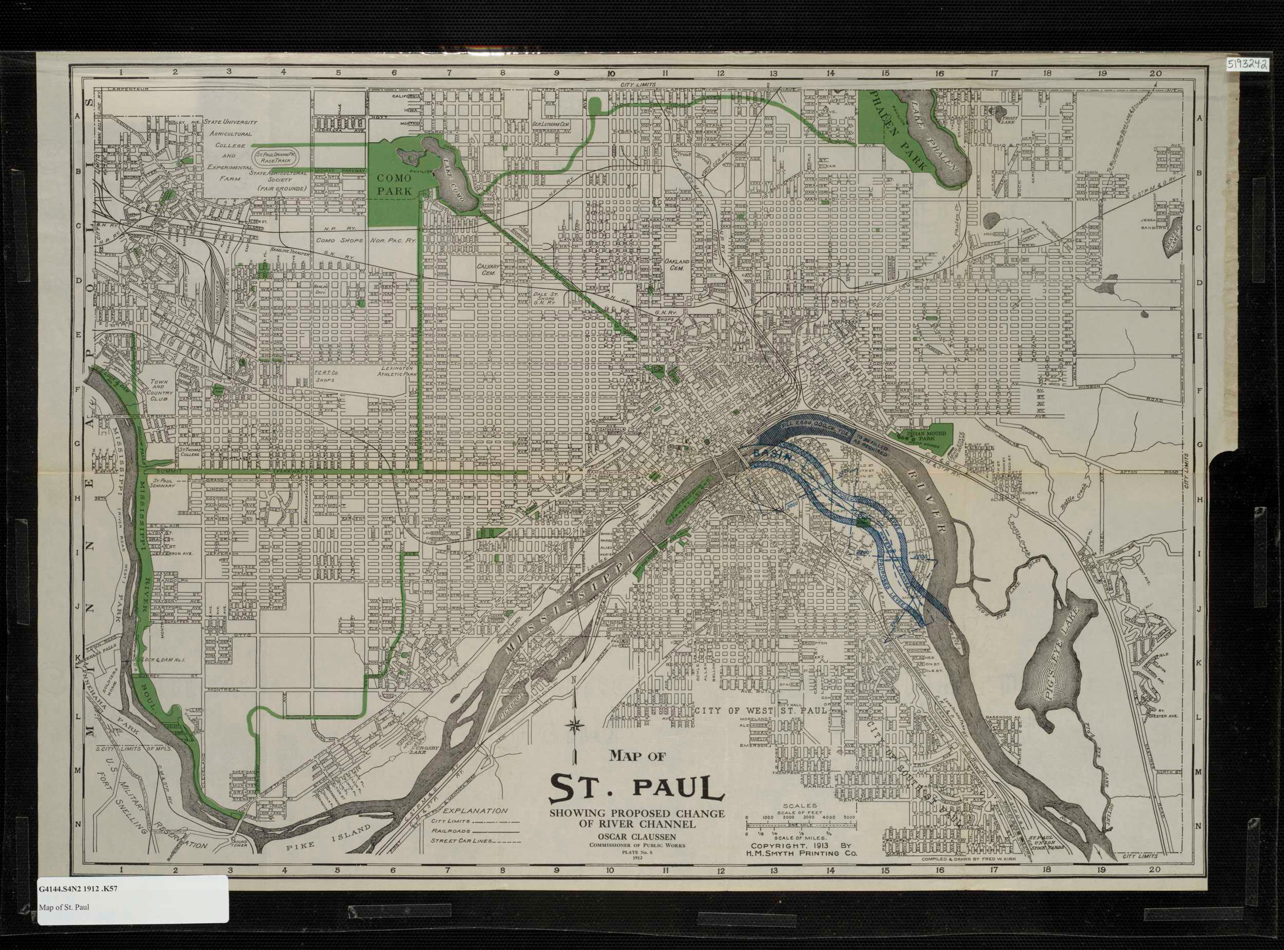
Map of St. Paul showing proposed change of river channel,
1912
Published by Fred
W. Kirk,
image courtesy of
the
John R. Borchert Map Library - click image to enlarge
Plat map of St. Paul, Minnesota, 1916
Click on map to be
taken to a
dynamic map, then click on the area you want to see the
detail of.
Resulting image will look like the sample
shown below showing details of each lot and building::
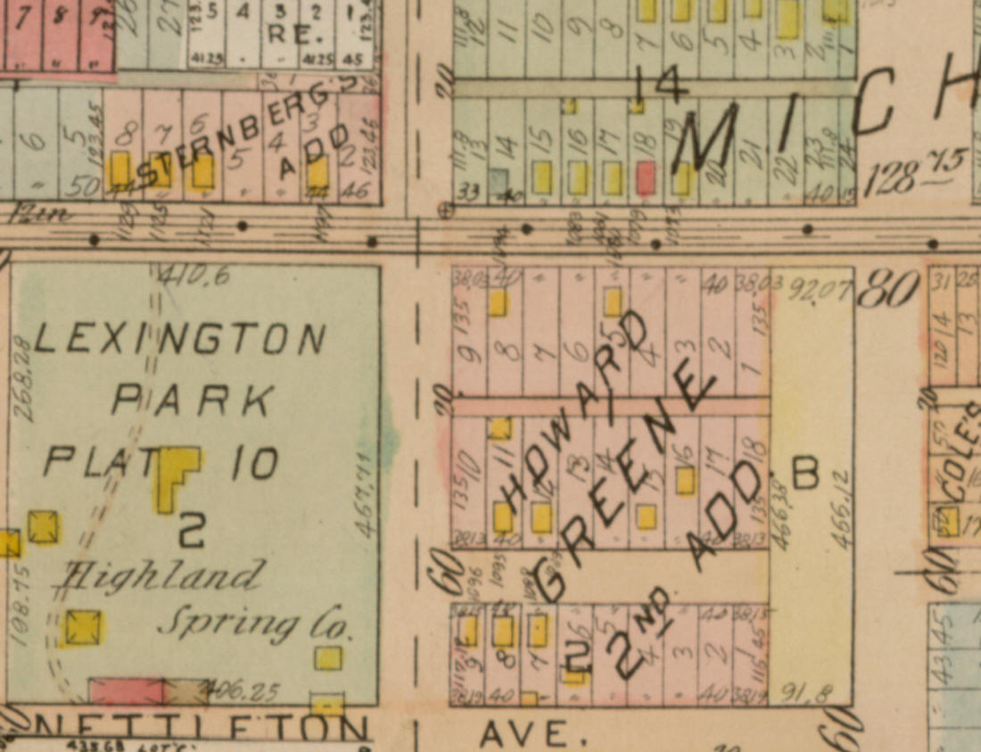
Published by G.M. Hopkins,
image courtesy of the
John
R. Borchert Map Library - click image to enlarge

Map of the City of St. Paul, Minnesota, 1922
Published by Hudson Map
Company,
image courtesy of the
John
R. Borchert Map Library - click image to enlarge

Map of the City of Saint Paul, Minnesota, 1931
From Saint Paul
Association of Commerce
- Image courtesy of David
Rumsey Historical Map Collection - click image to enlarge

Growth of St. Paul City Limits, 1952
Courtesy
City of St. Paul,
Minnesota, 1952
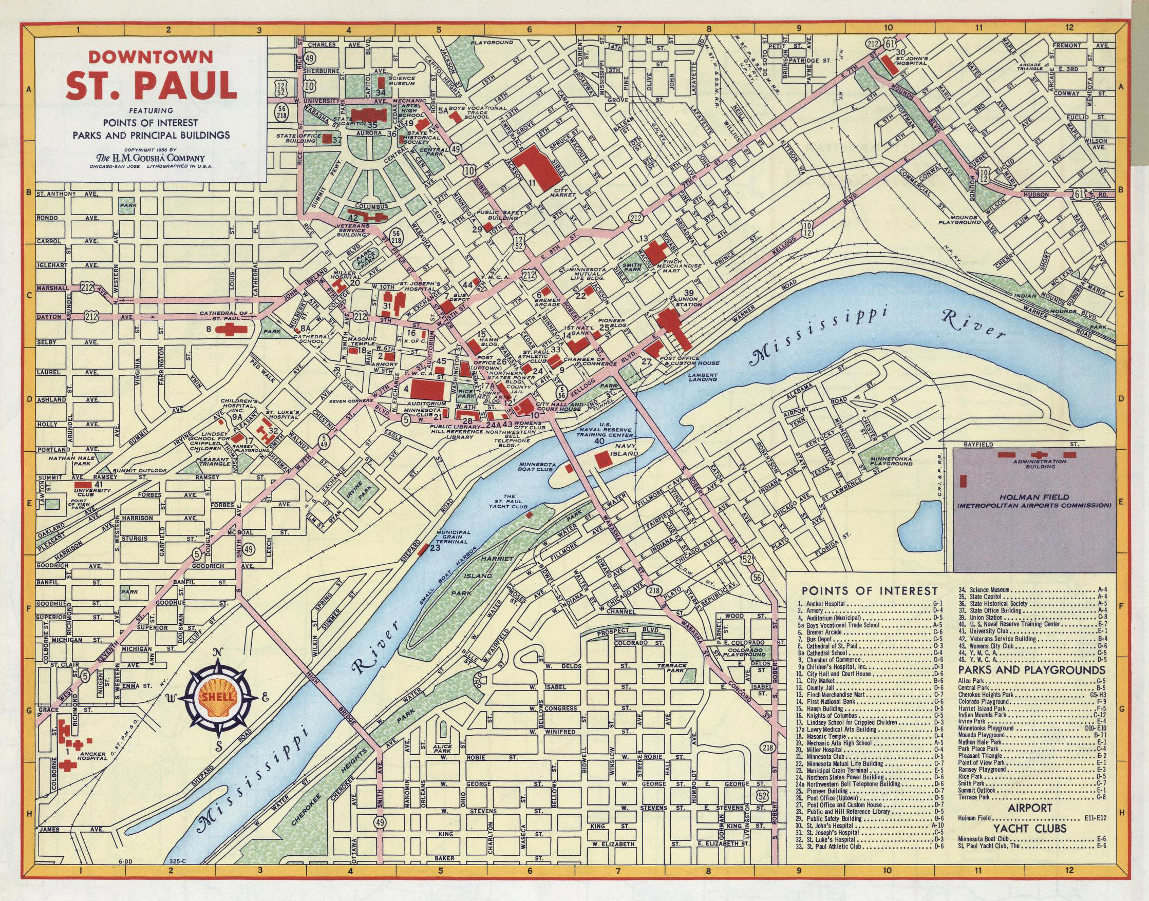
Street map of Downtown St. Paul, Minnesota, 1956
© 1956 by H.M. Gousha Company,
Image courtesy of David
Rumsey Historical Map Collection - click image to enlarge
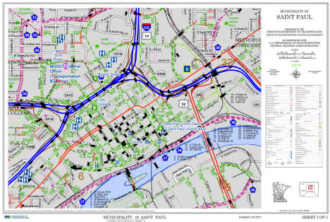
Downtown St. Paul Map, 2019
Courtesy
Minnesota Department
of Transportation - click image to rnlarge
|
|
|
|
|||||
|
|
© 2004-2022 Lakeweb1 Internet Services All Rights Reserved |
|
|||
|
| |||||