|
|
|
|
|
|
Navigation LakesnWoods.com
© 2004-2025 DCMA, Defamation, Copyright and Trademark Infingement Policy
|
|
||||||||||||||||||||||||||||||||||||||||||||||||||||||||||||||||||||||||||||||||||||||||||||||||||||||||||||||||||||||||||||||||||||||||||||||||||||||||||||||||||||||||||||||||||||||||||||||||||||||||||||||||||||||||||||||||||||||||||||||||||||||||||||||||||||||||||||||||||||||
 |
| West St. Paul (city) | 1970 | 1980 | 1990 | 2000 | 2008 (est) |
1990-2000 Change | |
|---|---|---|---|---|---|---|---|
| Actual | Percent | ||||||
| Population | 18,802 | 18,527 | 19,248 | 19,405 | 19,002 | 157 | 0.82 |
| Land Area (sq. mile) | 5.00 | 5.03 | 5.01 | 5.01 | -- | -0.00 | -0.03 |
| Density (persons per sq. mile) | 3,760.40 | 3,683.30 | 3,841.92 | 3,874.23 | -- | 32.32 | 0.84 |
| Housing Units | 6,512 | 7,685 | 8,767 | 8,779 | -- | 12 | 0.14 |
| Households | -- | 7,501 | 8,441 | 8,645 | 8,680 | 204 | 2.42 |
| Persons Per Household | -- | 2.43 | 2.24 | 2.20 | 2.14 | -0.04 | -1.92 |
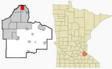
West Saint Paul is a city in Dakota County, Minnesota, immediately south of the city of Saint Paul, Minnesota. The quirky naming in part comes from the fact that the city is on the "west" bank of the Mississippi River—the river flows toward the east at this point. U.S. Highway 52, Robert Street, and Minnesota Highway 110 are three of the main routes in the city. Interstate Highway 494 runs just south of the city and Minnesota Highway 3 (unmarked Route 952) runs through the middle of the city as Robert Street. According to the United States Census Bureau, the city has a total area of 5.0 square miles (13.0 km²), of which, 5.0 square miles (13.0 km²) of it is land and 0.04 square miles (0.1 km²) of it (0.40%) is water. The elevation is 1,027 ft (313 m) above sea level.
From Wikipedia, the free encyclopedia.
There were 8,645 households out of which 24.6% had children under the age of 18 living with them, 42.4% were married couples living together, 10.7% had a female householder with no husband present, and 43.6% were non-families. 37.1% of all households were made up of individuals and 15.9% had someone living alone who was 65 years of age or older. The average household size was 2.20 and the average family size was 2.93.
In the city the population was spread out with 21.1% under the age of 18, 8.9% from 18 to 24, 28.7% from 25 to 44, 22.1% from 45 to 64, and 19.2% who were 65 years of age or older. The median age was 39 years. For every 100 females there were 87.3 males. For every 100 females age 18 and over, there were 83.1 males.
The median income for a household in the city was $41,103, and the median income for a family was $56,786. Males had a median income of $39,344 versus $29,836 for females. The per capita income for the city was $23,558. About 3.8% of families and 5.9% of the population were below the poverty line, including 6.6% of those under age 18 and 5.2% of those age 65 or over.
Visit The
Minnesota History Shop! |
Courtesy Minnesota Historical Society
|
West St. Paul City Hall 1616 Humboldt Avenue West St. Paul, MN 55118 Phone: (651) 552-4100 Regular Business Hours: Monday - Friday 8:00 am - 4:30 pm City Council Meetings: 2nd and 4th Monday of the month at 6:30 pm 


 |
||||
| Title | Term Ends | Name and Address | Phone | |
| Mayor | 12/31/2022 |
Dave Napier 1776 Vivian Lane West St. Paul, MN 55118 |
|
(612)
562-9773 (651) 755-2639 |
| City Manager | appointed |
Nate Burkett 1616 Humboldt Avenue West St. Paul, MN 55118 |
|
(651) 552-4101 |
| Council Member - Ward 1 | 12/31/2022 |
Richard "Dick" Vitelli 423 Mainzer Street West St. Paul, MN 55118 |
|
(651) 460-0419 |
| Council Member - Ward 1 | 12/31/2024 |
Julie A. Eastman 443 Bernard Street E West St. Paul, MN 55118 |
|
(651) 270-3392 |
| Council Member - Ward 2 | 12/31/2022 |
John Justen 214 Curtice Street W West St. Paul, MN 55118 |
|
(763) 442-1107 |
| Council Member - Ward 2 | 12/31/2024 |
Robyn Gulley 1045 Gorman Avenue West St. Paul, MN 55118 |
|
(612) 558-6019 |
| Council Member - Ward 3 | 12/31/2022 |
Wendy Barry 1125 Charlton Street West St. Paul, MN 55118 |
|
(612) 414-2749 |
| Council Member - Ward 3 | 12/31/2024 |
Lisa Eng-Sarne 344 Emerson Avenue W West St. Paul, MN 55118 |
|
(651) 757-7090 |
|
US Post Office 1201 Robert Street S West St. Paul, MN 55118-2314 Phone: (651) 455-9551 Toll Free: (800) ASK-USPS
Regular Business Hours:
|
|
| PERFECT GIFTS! These designs available on over 100 different items - Men's Clothing - Hats - Tote Bags - Women's Clothing - Mugs - Buttons - Children's Clothing - Clocks - Stickers - and more! | ||
 |
 |
 |
| West St. Paul Established 1889 Merchandise | West St. Paul Chick Merchandise | I Love West St. Paul Merchandise |
| This
great design is available on over 100 different items! |
This
great design is available on over 100 different items! |
'I Love' Merchandise also available for dozens of other cities in Minnesota! |
| Utility Type | Utility Name | Utility Phone |
| Electricity | Xcel Energy | (800) 367-7414 |
| Natural Gas | Xcel Energy | (800) 367-7414 |
| Wastewater | Metropolitan Council Environmental Svc | (651) 602-1000 |
| Water | St. Paul Regional Water Services | (651) 266-6350 |
| Telephone | CenturyLink Communications | (800) 244-1111 |
| Cable TV | Comcast | (651) 222-3333 |
| Employer | Products/Services | Employees |
| I.S.D. No. 197-West St. Paul, Mendota Hts., Eagan | Elementary & Secondary Schools | 651 |
| Dakota Company | Admin. of Human Resource Programs | 577 |
| Target | Department Stores | 400 |
| Southview Acres Health Care | Nursing Care Facilities | 375 |
| Wal-Mart | Department Stores | 300 |
| Tapemark Company | Pulp, Paper & Paperboard Mills | 250 |
| Darts | Special Needs Transp. | 179 |
| Cub Foods | Grocery Stores | 165 |
| YMCA | Sports Teams & Clubs | 145 |
| City of West St. Paul | Executive, Legislative, & Other Gen. Govt. Support | 141 |
| Menards | Building Material & Supplies Dealers | 140 |
| Rainbow Foods | Grocery Stores | 124 |
| K Mart | Department Stores | 100 |
| Southview Country Club | Sports Teams & Clubs | 76 |
| RTC Plastics | Resin, Synth. Rubber & Art. Synth. Fibers & Fil. Mfg. | 74 |
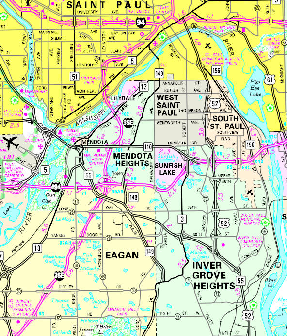
Minnesota State
Highway Map of the West St. Paul, Minnesota area
| PERFECT GIFTS! These designs available on over 100 different items - Men's Clothing - Hats - Tote Bags - Women's Clothing - Mugs - Buttons - Children's Clothing - Clocks - Stickers - and more! | ||
 |
 |
 |
| West St. Paul Beer Drinking Team Merchandise | West St. Paul Minnesnowta Merchandise | I Love West St. Paul Merchandise |
| This
great design is available on over 100 different items! |
This
great design is available on over 100 different items! |
'I Love' Merchandise also available for dozens of other cities in Minnesota! |
Check Out
The Minnesota
History Shop! Good Goods and
Great Gifts! |
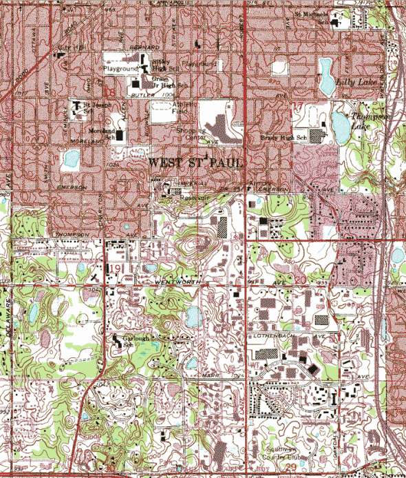
| Lake Name | Size (acres) |
Lake info | Lake Map | Rec Map | Topo Map |
|---|---|---|---|---|---|
|
|
|
|
|
|
West St. Paul-Mendota
Heights-Eagan Area Schools Independent School District #197 1897 Delaware Avenue Mendota Heights, MN 55118 Phone: (651) 403-7000 Welcome to West St. Paul-Mendota Heights-Eagan Area Schools, also known as School District 197! Our district is comprised of eight close-knit schools that serve more than 5,000 students from the communities of Eagan, Inver Grove Heights, Lilydale, Mendota, Mendota Heights, Sunfish Lake, and West St. Paul in Minnesota. School District 197 is fortunate to have a vibrant school community filled with a variety of academic, athletic, and artistic opportunities for students at every age, from early learning to grade 12. Grades: PK-12 Students: 5,172
|
 |
|
Henry Sibley High
School 1897 Delaware Avenue Mendota Heights, MN 55118 Phone: (651) 403-7100 Grades: 9-12 Students: 1,430
|
 |
|
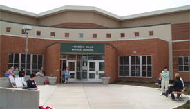
Friendly Hills
Middle School 701 Mendota Heights Road Mendota Heights, MN 55120 Phone: (651) 403-7600 Grades: 5-8 Students: 742
|
 |
|
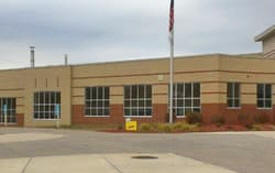
Heritage E-STEM
Magnet School 121 W Butler Avenue West St. Paul, MN 55118 Phone: (651) 403-7400 Grades: 5-8 Students: 759
|
 |
|
Garlough
Environmental Magnet School 1740 Charlton Street West St. Paul, MN 55118 Phone: (651) 403-8100 Grades: K-4 Students: 446
|
 |
|
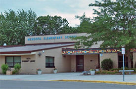
Mendota Elementary
School 1979 Summit Lane Mendota Heights, MN 55118 Phone: (651) 403-8000 Grades: PK-4 Students: 427
|
 |
|
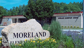
Moreland Arts &
Health Sciences Magnet School 217 W Moreland Avenue West St. Paul, MN 55118 Phone: (651) 403-7800 Grades: K-4 Students: 409
|
 |
|
Pilot Knob STEM
Magnet School 1436 Lone Oak Road Eagan, MN 55121 Phone: (651) 403-7900 Grades: K-4 Students: 395
|
 |
|
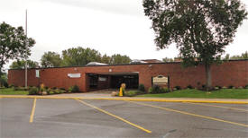
Somerset Elementary
School 1355 Dodd Road Mendota Heights, MN 55118 Phone: (651) 403-8200 Grades: PK-4 Students: 414
|
|
Phone: (651) 403- Grades: Students:
|
| Local | |
| Metro | |
|
see the Twin Cities Media Guide page for Twin Cities metro area newspapers, radio and TV |
|
|
none |
|
none |
|
|
|
|
|
|
© 2004-2025 LakesnWoods LLC All Rights Reserved |
|
|
|
||