|
Navigation
LakesnWoods.com
Home
Page
Contact Us
Privacy
Minnesota History Shop
Visit The Minnesota History Shop
www.minnesotahistoryshop.com
Historic maps
Historic books
Historic framed art
Historic
postcards
Clothing with historic
images
And much more!!! |
Wirt Guide:
Location
Geography
Demographics
History
Government
Post Office
News
Weather
Street Map
Events
Attractions
Recreation
Lakes
Health Care
Schools
Churches
Media
Motels
Resorts
Campgrounds
Businesses
Aerial Photo
Topographic Map © 2004-2025
LakesnWoods LLC
All Rights Reserved
DCMA, Defamation, Copyright and Trademark Infingement Policy
|
WANTED! Do you have photos, historical accounts or
other items pertaining to the Wirt area? Would you like to
share this historical information with the world?
LakesnWoods.com would like to publish your Wirt photos
(current or historical) or historical accounts on this website.
Original materials can be returned and your privacy will be
respected.
Contact us |
|
Wirt Minnesota Community Guide
Location:
Population:
| Wirt (township) |
1970 |
1980 |
1990 |
2000 |
2010 |
2000-2010
Change |
| Actual |
Percent |
| Population |
94 |
82 |
84 |
94 |
106 |
+12 |
+12.77 |
| Land Area (sq. mile) |
33.10 |
35.21 |
34.11 |
34.10 |
34.10 |
0 |
0.00 |
| Density (persons per sq. mile) |
2.84 |
2.33 |
2.46 |
2.76 |
3.11 |
+0.35 |
+12.77 |
| Housing Units |
66 |
96 |
81 |
94 |
107 |
+13 |
+13.83 |
| Households |
-- |
30 |
32 |
36 |
51 |
+15 |
+41.67 |
| Persons Per Household |
-- |
2.73 |
2.63 |
2.61 |
2.08 |
-0.53 |
-20.31 |
Geography:
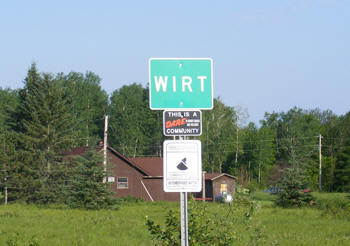
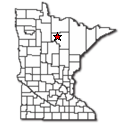
Wirt Township is a township in Itasca County,
Minnesota. The community is located 16 miles northwest of Talmoon at the
junction of Itasca County Roads 29 and 31. County Road 14 is also
nearby. The Big Fork River flows through the community. According to the
United States Census Bureau, the township has a total area of 36.2
square miles (93.7 km˛), of which 34.1 square miles (88.3 km˛) is land
and 2.1 square miles (5.4 km˛), or 5.72%, is water. The elevation is
1,335 feet (406 m).
From
Wikipedia, the free
encyclopedia.
Demographics:
As of the census of 2000, there are 94 people,
36 households, and 24 families residing in the township. The population
density is 1.1/km˛ (2.8/mi˛). There are 94 housing units at an average density
of 1.1/km˛ (2.8/mi˛). The racial makeup of the township is 90.43% White,
0.00% African American, 5.32% Native American, 1.06% Asian, 0.00% Pacific
Islander, 2.13% from other races, and 1.06% from two or more races. 0.00%
of the population are Hispanic or Latino of any race. There are 36 households
out of which 33.3% have children under the age of 18 living with them, 63.9%
are married couples living together, 0.0% have a female householder with
no husband present, and 30.6% are non-families. 22.2% of all households
are made up of individuals and 13.9% have someone living alone who is 65
years of age or older. The average household size is 2.61 and the average
family size is 3.16. In the township the population is spread out with 26.6%
under the age of 18, 5.3% from 18 to 24, 26.6% from 25 to 44, 20.2% from
45 to 64, and 21.3% who are 65 years of age or older. The median age is
41 years. For every 100 females there are 113.6 males. For every 100 females
age 18 and over, there are 109.1 males. The median income for a household
in the township is $32,500, and the median income for a family is $33,125.
Males have a median income of $28,000 versus $41,250 for females. The per
capita income for the township is $14,794. 5.5% of the population and 7.1%
of families are below the poverty line. Out of the total people living in
poverty, 12.1% are under the age of 18 and 0.0% are 65 or older.
History:
Wirt Township was named by O. E. Walley, its first settler,
probably for a township in New York or a county in West Virginia, where
the name was given in honor of William Wirt (1772-1834), who was the attorney
general of the United States, 1817-29. The village in sections 10 and 15
was established as a logging supply station on the Minneapolis and Rainy
River Railway; its post office began in 1874 and was changed to a community
post office in 1974. Elias O. Walley was the first settler, opening a store
and becoming the first postmaster. The first site was on the north side
of the Big Fork River with a store, a post office, and a hotel; the present
community is across the river on the site of a former logging town, called
Stanley by the railroad. Courtesy
Minnesota Historical Society More
Wirt History
Government:
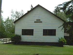
Wirt Township Hall
52140
County Road 31
Wirt, MN 56688


 |
 |
| Title |
Term Ends |
Name and
Address |
|
Phone |
| Clerk |
12/31/2022 |
Cheryl Carrigan
52026 County Road 31
Wirt, MN 56688 |
 |
(218)
659-2734 |
| Treasurer
|
12/31/2024 |
Cindy Klegstad
58286 Bass Lake Road
Wirt, MN 56688 |
|
(218)
659-2686 |
| Supervisor
|
12/31/2022 |
Debra
Schanno
52385
County Road 31
Wirt, MN 56688 |
|
(218)
659-2740 |
| Supervisor
|
12/31/2022 |
Laurine Graning
52115
County Road 31
Wirt, MN 56688 |
|
(715) 558-5527
(218)
659-2104 |
| Supervisor
|
12/31/2024 |
Gregg
Pike
57771 E Lake Road
Wirt, MN 56688 |
|
(218)
659-4420 |
|
State |
|
|
|
| MN House - District
5A |
12/31/2022 |
Matt Bliss (R)
311 State Office Building
St. Paul,
MN 55155 |

 |
(651) 296-5516 |
| MN Senate - District
5 |
12/31/2024 |
Justin Eichorn (R)
Minnesota Senate Bldg. Rm 3213
St. Paul, MN
55155 |

 |
(651) 296-7079 |
| MN Governor |
12/31/2022 |
Governor Tim Walz
75 Rev Dr. Martin Luther King Jr.
St. Paul, MN 55155 |

 |
(651) 201-3400
(800) 657-3717 |
|
Federal |
|
|
|
| US House - District 8 |
12/31/2022 |
Pete Stauber (R)
461 Cannon HOB
Washington, DC 20515 |

 |
(202) 225-6211 |
| US Senate |
12/31/2022 |
Amy Klobuchar (DFL)
425 Dirksen Senate Building
Washington, DC 20510 |

 |
(202) 224-3244 |
| US Senate |
12/31/2022 |
Tina Smith (DFL)
720 Hart Senate Office Bldg.
Washington, DC 20510 |

 |
(202) 224-5641 |
| US President |
12/31/2024 |
Joe Biden (D)
1600
Pennsylvania Avenue NW
Washington, DC 20500 |

|
not available |
Post Office:
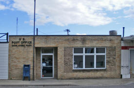
Served by the Deer River Post Office
US Post Office
12 1st Avenue NE
Deer River, MN 56636
Phone: (218) 246-8440
Toll Free: (800) ASK-USPSRegular Business Hours:
Week Days
8:30 am - 12:00 pm
1:00 pm - 4:15 pm
Saturday
Closed
 
|
 |
News:
Weather:
Map:
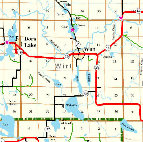
From
Itasca
County Official Map
Events:
|
none locally Wirt had an annual 'Corn Days Festival' held annually
in August, but this was discontinued several years ago. |
|
Attractions:
Recreation:
Lakes:
|
Lake Name |
Size
(acres) |
Lake info |
Lake Map |
Rec Map |
Topo Map |
|
Clear |
137 |
 |
 |
 |
 |
|
Helen |
n/a |
n/a |
n/a |
 |
 |
|
Holloway (Bass) |
193 |
 |
 |
 |
 |
|
Killdeer |
104 |
n/a |
 |
 |
 |
| Noma |
55 |
 |
 |
 |
 |
|
Whitefish |
565 |
 |
 |
 |
 |
Health
Care:
|
Nearest hospital and clinic are in
Bigfork |
Schools:
|
Part of Deer River Independent
School District 317
Elementary and
High school students attend
Deer
River Schools (35 miles) |
Churches:
Media:
Motels:
Resorts:
|
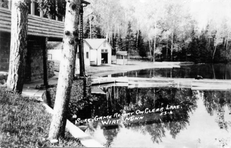
Sure Game Resort, Wirt Minnesota, 1940s
LakesnWoods.com Postcard and Postcard Image Collection - click to enlarge |
Campgrounds:
Businesses:
Aerial
Photo:
Topographic Map:
[click image to enlarge, zoom in or zoom out]
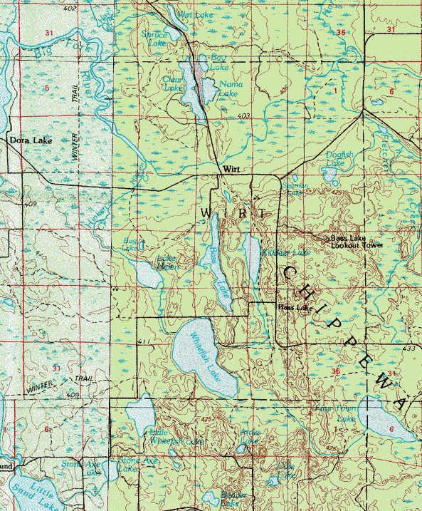 Topographic map is courtesy of the Minnesota DNR -
click map to zoom or enlarge
 |
|


