|
|
 |
|
|
Navigation
LakesnWoods.com
Cass Lake Guide: Nearby Communities © 2004-2025
DCMA, Defamation, Copyright and Trademark Infingement Policy
WANTED! Do you have photos, historical accounts or
other items pertaining to the Cass Lake area? Would you like to
share this historical information with the world?
LakesnWoods.com would like to publish your Cass Lakes photos
(current or historical) or historical accounts on this website.
Original materials can be returned and your privacy will be
respected.
Chippewa National Forest New
Vintage Logo Shirt
(available for men, women and children on t-shirts, sweatshirts
and more)
|
Population:
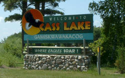
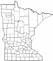
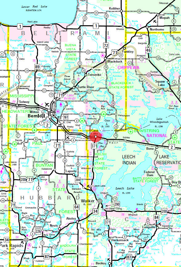
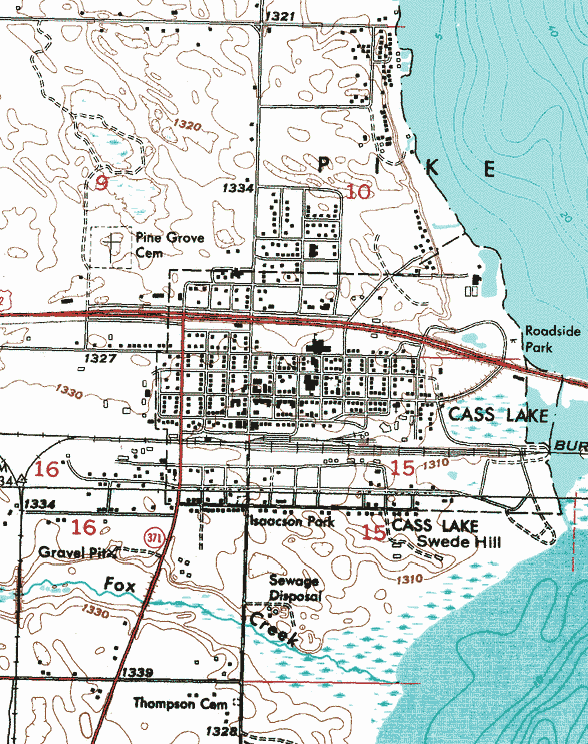
Geography: Cass Lake is a city in Cass County, Minnesota, United States, within the reservation boundaries of the Leech Lake Band of the Ojibwe nation. U.S. Route 2 and Minnesota State Highway 371 are two of the main routes in the city. According to the United States Census Bureau, the city has a total area of 1.14 square miles (2.95 km˛), all of it land. The elevation is 1,332 ft (406 m). The city is located on the shore of its namesake Cass Lake, which was named in honor of Michigan Governor Lewis Cass. From Wikipedia, the free encyclopedia Demographics: As of the census of 2010, there were 770 people, 305 households, and 164 families residing in the city. The population density was 675.4 inhabitants per square mile (260.8/km2). There were 371 housing units at an average density of 325.4 per square mile (125.6/km2). The racial makeup of the city was 24.3% White, 0.3% African American, 67.9% Native American, 0.8% Asian, 0.1% from other races, and 6.6% from two or more races. Hispanic or Latino of any race were 2.2% of the population. There were 305 households of which 34.8% had children under the age of 18 living with them, 17.0% were married couples living together, 25.9% had a female householder with no husband present, 10.8% had a male householder with no wife present, and 46.2% were non-families. 40.3% of all households were made up of individuals and 18.4% had someone living alone who was 65 years of age or older. The average household size was 2.52 and the average family size was 3.29. The median age in the city was 31.8 years. 30.9% of residents were under the age of 18; 10.1% were between the ages of 18 and 24; 23.3% were from 25 to 44; 21.9% were from 45 to 64; and 13.8% were 65 years of age or older. The gender makeup of the city was 48.6% male and 51.4% female. From Wikipedia, the free encyclopedia History: CASS LAKE, a city in Pike Bay Township, on the Leech Lake Reservation, received its name from the adjoining lake, which, as before noted, was named, like this county, in honor of Gen. Cass. Established in 1898, the city was a fast-growing tourist area because of its proximity to Cass Lake, Pike Bay, and the numerous other lakes of the area; it had ten hotels by 1920 and a station of the Great Northern Railway. Most of its residents were employed in the chief industry of lumbering. The post office was named Tuller in 1898, changing to Cass Lake in 1899; an earlier post office by this name was established and discontinued in that part of the county that was formerly Pembina County, 1852-57. Courtesy of the Minnesota Historical Society PERMANENT HOME OF THE PINE Cass Lake (1,323 alt., 1,904 pop.), on the western shore of Cass and the largest community in Cass County, is the "capital of the Chippewa Nation." The Indian name for the lake meant "the-place-of-the-red-cedars," the first whites in the region called it Upper Red Cedar Lake. Fur traders reached it when following the Mississippi River in their search for pelts, and in 1794 Perrault built a post for the Northwest Fur Company at the entrance of the Red Cedar River. Although technically American territory, the region, for many years, was dominated by the English. The search for the source of the Mississippi brought explorers, and in 1820 the Cass Expedition, headed by Territorial Governor Lewis Cass of Michigan, who was visiting all the Indian tribes under his jurisdiction, reached Upper Red Cedar Lake. Henry R. Schoolcraft, who accompanied Cass, did not agree with the leader's opinion that the head of the great river was Elk Lake. In 1832, Schoolcraft returned with his own expedition and discovered Lake Itasca, the true source; he renamed Upper Red Cedar Lake in honor of Cass. Until the early 1850s, the area was covered with dense forests of pine, poplar, oak, cedar, maple, birch and spruce. After the organization of Cass County in 1851, lumbermen swarmed in, and logging camps and saw and planing mills sprang up. The Cass Lake Settlement grew, and the arrival of the Great Northern in 1898 hastened the platting of the town site in 1899. The coming of the Minneapolis, St. Paul and Sault Ste. Marie Railroad (Soo Line) in 1900 was also an important factor in the development of the community. While lumbering was the community's mainstay for decades, with a sawmill and crating factory still operating, farming and dairying have been developed on the cut-over lands. Resorts, recreational facilities, and scenic beauty attract many visitors to Cass Lake. The town borders the Chippewa National Forest. The U. S. Forest Supervisors' Building (2nd St. bet. 6th and 7th Ayes.) is a three-story log structure that adjoins the U. S. Government Nursery, the world's largest pine nursery (1939), supplying 64,000,000 seedlings annually to the Chippewa and other near-by national forests. Cass Lake village is the headquarters of the Consolidated Chippewa Indian Agency (2nd St. bet. Central and 1st Aves.) that has jurisdiction over seven reservations, five of which are in the Minnesota Arrowhead: Leech Lake (see Walker), Fond du Lac, Nett Lake, Vermilion (see Tower), and Grand Portage (see Arrowhead Tour 1). The General Chippewa Hospital (US 371 and US 2 bet. 3rd and 4th Ayes.) offers modern surgical and other medical care to the Indians. The lake (Cass), six miles long and from three to five wide, is crossed by US 2, as it enters the village from the east. To the south is Pike Bay, an arm of the lake. Star Island, the largest of several islands in the lake proper, is one of the town's most interesting scenic and recreational spots. Shaped like a star, the island was mapped and described by Schoolcraft, who called it "Colcaspi" in honor of its three explorers (Schoolcraft, Cass, and Pike). In the middle of this 1,200-acre island and surrounded by a forest of virgin pine is Lake Windigo, formerly the domain of Chief Yellow Head (Ozawindib), Schoolcraft's guide, whose band of 160 lived on the northeast point, now O'Neil's Point, where the site of the old Indian village is visible. From the WPA Guide to the Minnesota Arrowhead
Company
Government:
Post Office:
Utilities:
Major Employers:
News: Weather: Map:
Events:
Attractions:
Recreation:
Lakes:
Health Care:
Schools:
Churches:
Media:
Motels:
Resorts: Campgrounds:
Businesses: Aerial Photo:
Topographic Map:
|
|||||||||||||||||||||||||||||||||||||||||||||||||||||||||||||||||||||||||||||||||||||||||||||||||||||||||||||||||||||||||||||||||||||||||||||||||||||||||||||||||||||||||||||||||||||||||||||||||||||||||||||||||||||||||||||||||||||||||||||||||||||||||||||||||||||||||||||||||||||||
|
||||||||||||||||||||||||||||||||||||||||||||||||||||||||||||||||||||||||||||||||||||||||||||||||||||||||||||||||||||||||||||||||||||||||||||||||||||||||||||||||||||||||||||||||||||||||||||||||||||||||||||||||||||||||||||||||||||||||||||||||||||||||||||||||||||||||||||||||||||||||
|
|
© 2004-2025
LakesnWoods LLC All Rights Reserved |
|
|
|
||
|
|
||

