Navigation

LakesnWoods.com
  Home
Page
  Contact Us
  Privacy
  Minnesota Gift Guide

Swatara Guide:
  Location
  Geography
  Demographics
  History
  Government
  Post Office
  News
  Weather
  Street Map
  Events
  Attractions
  Recreation
  Lakes
  Health Care
  Schools
  Churches
  Media
  Motels
  Resorts
  Campgrounds
  Businesses
  Aerial Photo
  Topographic Map

© 2004-2024
Lakeweb1 Internet Services
All Rights Reserved

DCMA, Defamation, Copyright and Trademark Infingement Policy


WANTED!

Do you have photos, historical accounts or other items pertaining to the Swatara area? Would you like to share this historical information with the world? LakesnWoods.com would like to publish your Swatara photos (current or historical) or historical accounts on this website. Original materials can be returned and your privacy will be respected.

Contact us


Swatara Minnesota Community Guide


Location:
Swatara Minnesota population sign


Population: 
 Macville Township 1970 1980 1990 2000 2010 2000-2010 Change
Actual Percent
Population 226 242 184 204 206 +2 +0.98
Land Area (sq. mile) 35.90 33.90 36.18 36.17 36.17 0 0.00
Density (persons per sq. mile) 6.30 7.14 5.09 5.64 5.70 +0.06 +0.98
Housing Units 74 107 115 107 164 +57 +53.27
Households -- 73 64 77 86 +9 +11.69
Persons Per Household -- 3.32 2.88 2.65 2.40 -0.25 -9.43

Geography:
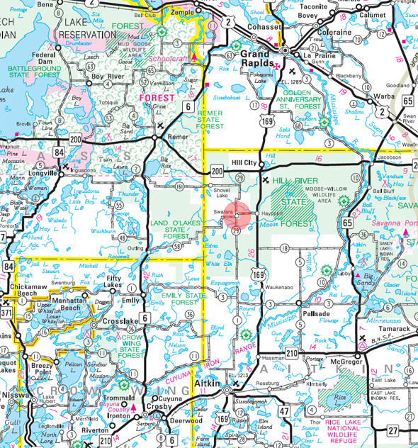
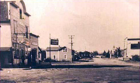
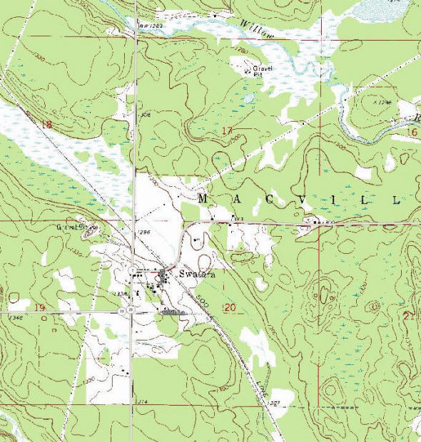
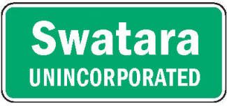
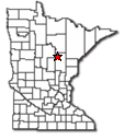
Swatara is an unincorporated community in Macville Township, Aitkin County, Minnesota. Swatara is located along Aitkin County Road 7 (610th Street) near the junction with County Road 29 (Osprey Avenue). Nearby places include Hill City, Remer, and Haypoint. U.S. 169 is nearby. Swatara is located in the northwest part of Aitkin County. It is 7 miles southwest of Hill City.

According to the United States Census Bureau, the township has a total area of 36.5 square miles (94.5 km2), of which 36.2 square miles (93.7 km2) is land and 0.31 square miles (0.8 km2), or 0.87%, is water. The elevation is 1,276 feet (389 m).

From Wikipedia, the free encyclopedia.


Demographics:

As of the census of 2000, there were 204 people, 77 households, and 51 families residing in the township. The population density was 5.6 people per square mile (2.2/km˛). There were 107 housing units at an average density of 3.0/sq mi (1.1/km˛). The racial makeup of the township was 97.06% White, 1.47% African American and 1.47% Native American. Hispanic or Latino of any race were 0.49% of the population.

There were 77 households out of which 29.9% had children under the age of 18 living with them, 51.9% were married couples living together, 7.8% had a female householder with no husband present, and 32.5% were non-families. 29.9% of all households were made up of individuals and 9.1% had someone living alone who was 65 years of age or older. The average household size was 2.65 and the average family size was 3.29.

In the township the population was spread out with 30.9% under the age of 18, 6.4% from 18 to 24, 28.4% from 25 to 44, 23.0% from 45 to 64, and 11.3% who were 65 years of age or older. The median age was 39 years. For every 100 females, there were 106.1 males. For every 100 females age 18 and over, there were 110.4 males.

The median income for a household in the township was $28,750, and the median income for a family was $31,875. Males had a median income of $24,531 versus $17,500 for females. The per capita income for the township was $13,859. About 19.6% of families and 28.5% of the population were below the poverty line, including 41.7% of those under the age of eighteen and 24.0% of those sixty five or over.

From Wikipedia, the free encyclopedia.


Visit The Minnesota History Shop!

History:  

SWATARA, a post office, 1903-8, and since 1911, Macville Township, section 20; it had a station on the Soo Line.

Courtesy Minnesota Historical Society

More Swatara History


Government:
Macville Township
Hill City MN 55748

Wikipedia  Email   
 
Title Term Ends Name and Address   Phone
Clerk 12/31/2024 William A. Flynn Jr.
61086 US Highway 169
Hill City MN 55748
Email (218) 340-0599
Treasurer 12/31/2022 Jennifer Byers
61086 US Highway 169
Hill City, MN 55748
  (218) 697-8493
Supervisor - Seat A
12/31/2024 Janet Hatfield
62195 350th Place
Hill City, MN 55748
  (218) 697-8443
Supervisor - Seat B 12/31/2022 Vernon Bishop
35375 600th Street
Hill City, MN 55748
  (218) 697-2419
Supervisor - Seat C 12/31/2024 Kenneth Janssen
62334 US Highway 169
Hill City, MN 55748
  (218) 820-7615
(218) 697-2556

Post Office:
None since 1988. Nearest Post Office is in Hill City.


News:
feedwidget @ Surfing Waves

Weather:

HILL CITY WEATHER


Street Map:

Minnesota State Highway Map of the Swatara Minnesota area


Events:

none


Attractions:

none


Recreation:

none


Lakes:
Lake Name Size
(acres)
Lake info Lake Map Rec Map Topo Map
     
 
Health Care:

none


Schools:

none


Churches:

none


Media:

none


Motels:

none


Resorts:

none


Campgrounds:

none


Businesses:


Main Street, Swatara Minnesota, 1947
From http://www.rootsweb.com/~mnaitkin/swatara.htm


Aerial Photo:   
Topographic Map:   [click map to enlarge, zoom in or zoom out]
Topographic map of the Swatara Minnesota area
Topographic map is courtesy of the Minnesota DNR - click map to zoom or enlarge

 
LakesnWoods.com    Home Page    Contact Us    Privacy 


© 2004-2024 Lakeweb1 Internet Services
All Rights Reserved