Click for Owatonna, Minnesota Forecast

Navigation

LakesnWoods.com
  Home
Page
  Contact Us
  Privacy


I Hate 35W
T-Shirts & Sweatshirts!

Design available on over 100 different items!

LakesnWoods.com Store


Fishing Lure Clock Wall Clock

Fishing Lure Wall Clock 
(design available on over 100 different items!)

LakesnWoods.com Store


Steele County Minnesota


Steele County is a county located in the U.S. state of Minnesota. It was named for Franklin Steele, a prominent early resident of the state. As of 2000, the population was 33,680. Its county seat is Owatonna.

According to the U.S. Census Bureau, the county has a total area of 432 square miles (1,119 kmē), of which 430 square miles (1,113 kmē) is land and 3 square miles (7 kmē) (0.61%) is water. The Straight River flows northwardly through the county, and the Le Sueur River flows through its southwestern corner. The Middle Fork of the Zumbro River has its headwaters in the northeastern part of the county.

Official Steele County website

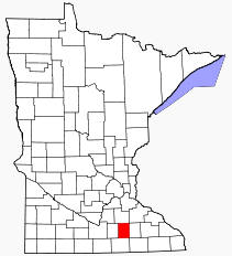
Location of Steele County Minnesota


Steele County Communities
Blooming Prairie Ellendale Medford Owatonna


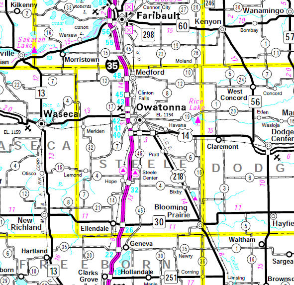
Minnesota State Highway Map

Minnesota State Highway Map of the Steele County Minnesota area


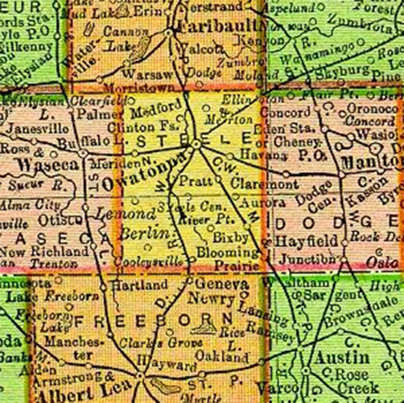
1895 Map of Steele County

1895 Map of Steele County Minnesota


LakesnWoods.com   Home
Page   Contact Us   Privacy 


Đ 2004 LakesnWoods LLC
All Rights Reserved